This past week was my last few days with my family in Texas. So I took Monday and Tuesday off so I could maximize my time. My sister (Rita) was a total rockstar these last few weeks trying to make sure I had somewhere to feature on my blog.
I am not originally from Texas, nor is my sister, but she married a Texan and she is a Texan through and through. She’s very proud of her state, and the small town where she has made her life. I love that about her. I also love that she actively seeks out interesting things and places where she lives. That’s really what this portion of my blog is about, appreciating the places around you. Be a tourist in your own town and find the hidden gems that make your home your home.
My sister was super excited to take me to Mrs. Lee’s Daffodil Garden. It was it’s first weekend open of the season and it’s definitely a unique experience for Gladewater. On Sunday they had proclaimed on their Facebook page that they were open for business, so Monday morning we took care of some errands in the morning, then picked up a couple of pizzas to eat as we drove through the beautiful daffodils… only to discover that they had decided that morning not to open. It was so disappointing.
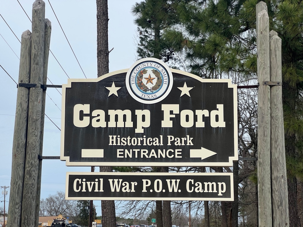
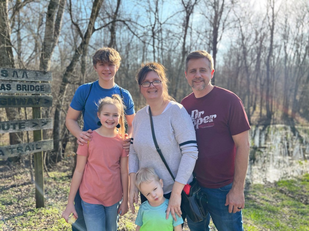
My three year old nephew was really disappointed that he didn’t get to see Mrs. Lees, so we decided to regroup at Gladewater Lake and let Brayden get some time running around in the sunshine. The weather was beautiful, the lake was pleasant, and there was a decent playground for the kiddos. My sister thought Camp Ford would be a great place to visit for Tourist Tuesday. So we picked my niece up from school before heading out of Gladewater to Tyler.
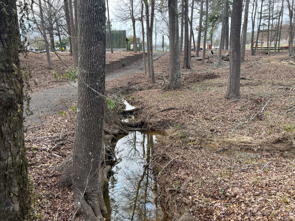
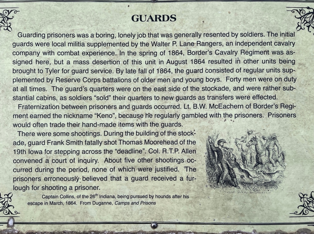
Camp Ford is an historical park where a Civil War P.O.W. Camp once stood. I really want to say that it’s a beautiful park and totally worth the trip to Tyler… but I’d be lying. Maybe sometime in the past, but it has fallen into disrepair; a couple of the trails were closed off for what appeared to be pretty unsafe conditions (one bridge had completely collapsed). Obviously it’s the end of winter, so the trees were still dead, and the ground was covered with fallen leaves, my guess is it’s quite beautiful in the spring and summer with all the foliage on full display.
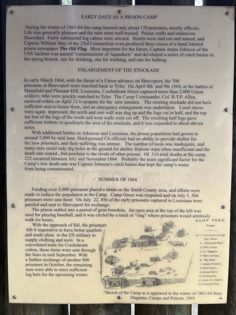
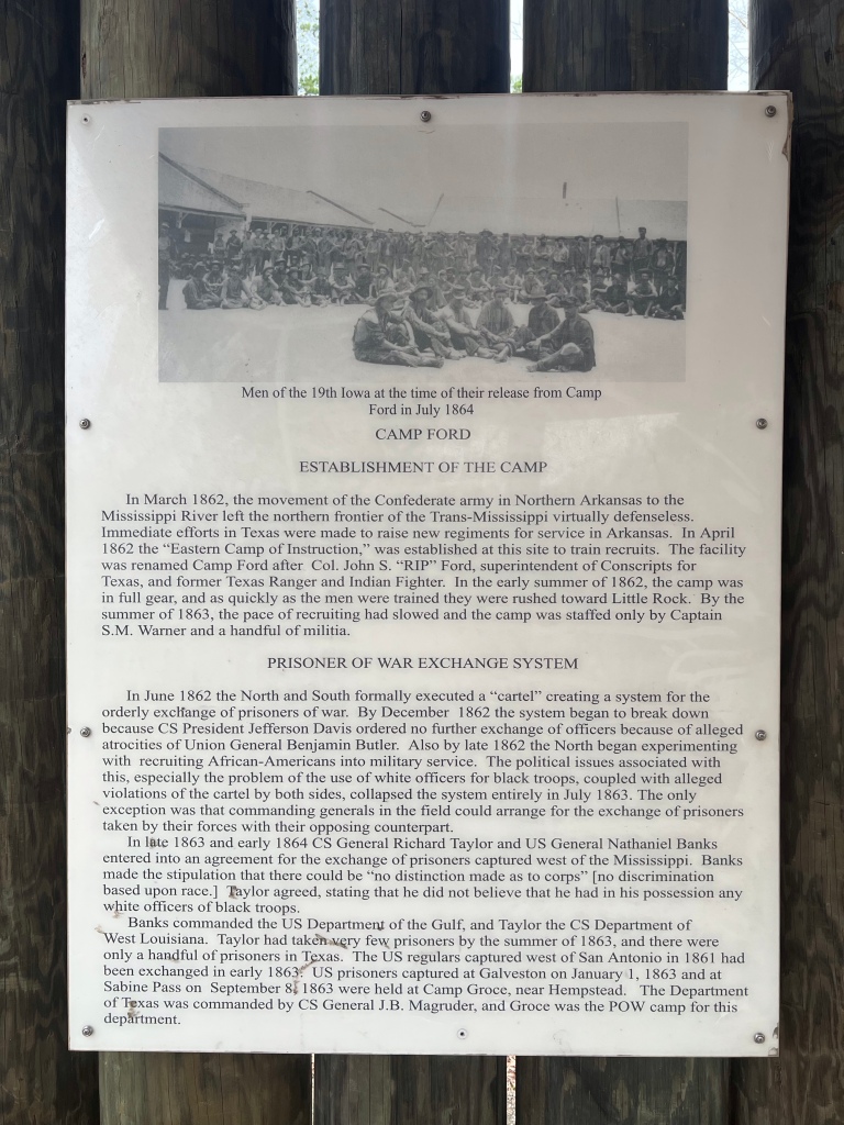
In spite of the rather dilapidated appearance of the park, it’s historical significance is interesting, and there were plenty of plaques with information regarding the usage and history of the camp. I had never considered prisoners of war during the Civil War, but they existed, and (apparently) the South held more prisoners than the North. The Union would have preferred to execute them for treason, but they were compelled to hold prisoners for exchange since the Confederacy held so many prisoners.
If you’re interested in reading some of the history I’m including photos of the plaques here:
Well… that’s a mouthful. I am still traveling, so I’m featuring another new city! After having a mini-reunion with my former roommates down in Austin, I headed to the piney woods of East Texas to visit my parents and my sister and her family. They live in the thriving metropolis of Gladewater, TX… and by thriving metropolis I mean cute little town of 6,134 (actually probably 6,133 since my nephew is currently living in Ohio for school) haha!
It’s definitely smaller than any town I’ve ever lived in, but it’s a great place to raise a family. My brother-in-law grew up here, and my sister moved here 21 years ago after they got married. My parents moved here about eight years ago, and live right next door to my sister, which is super convenient for visits.
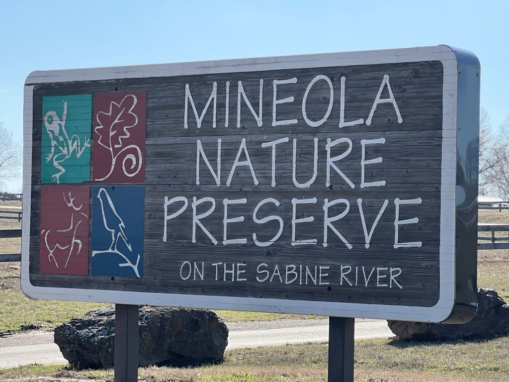
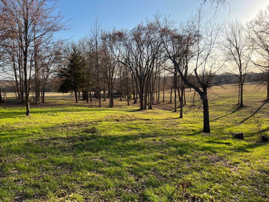
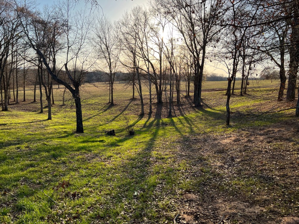
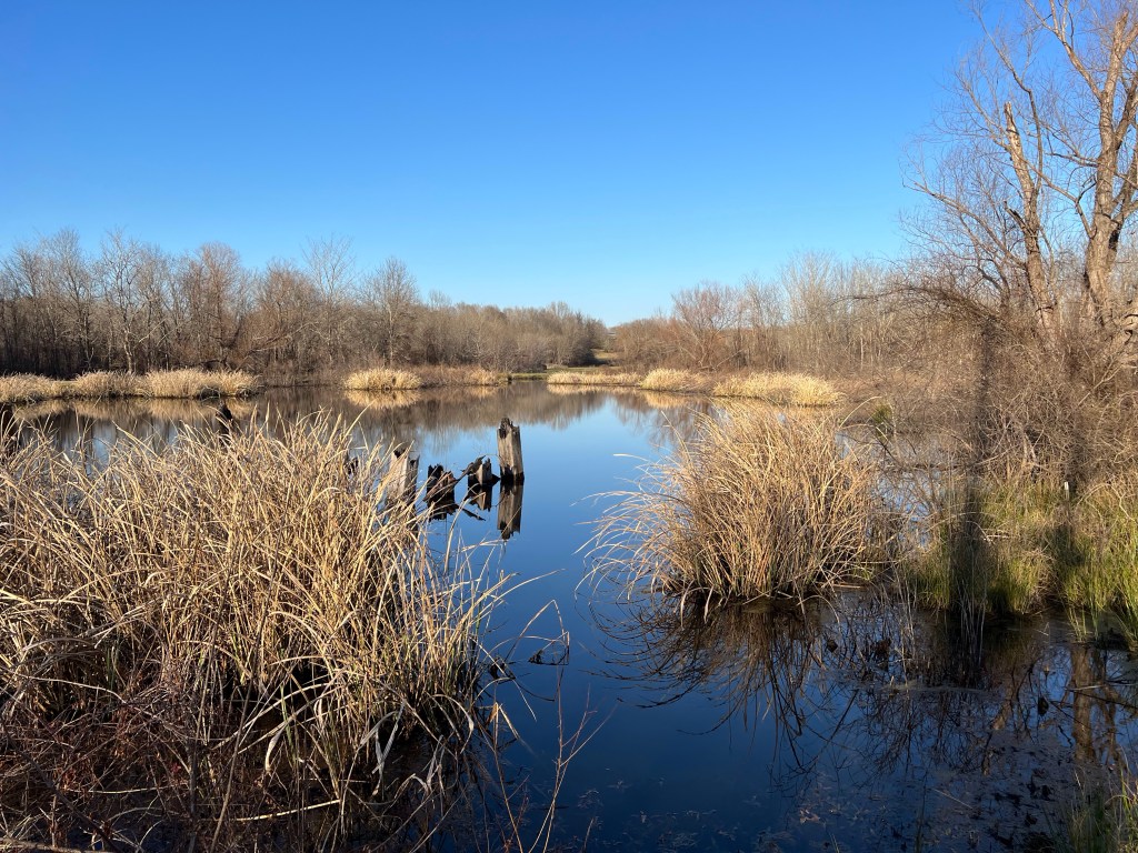
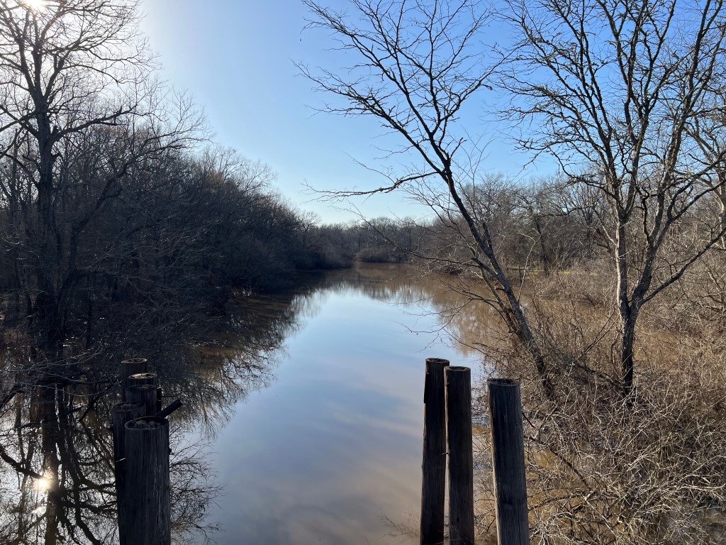
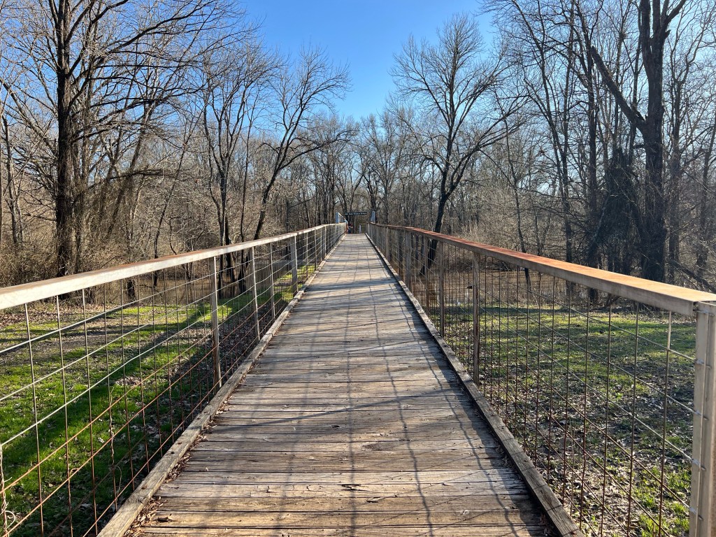
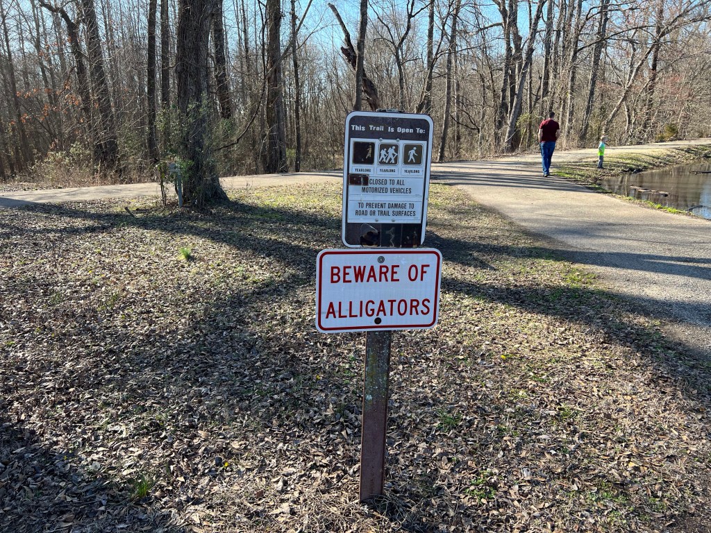
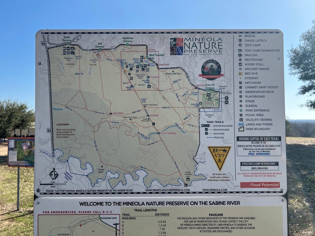
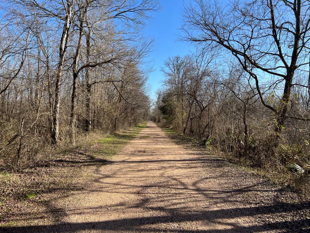
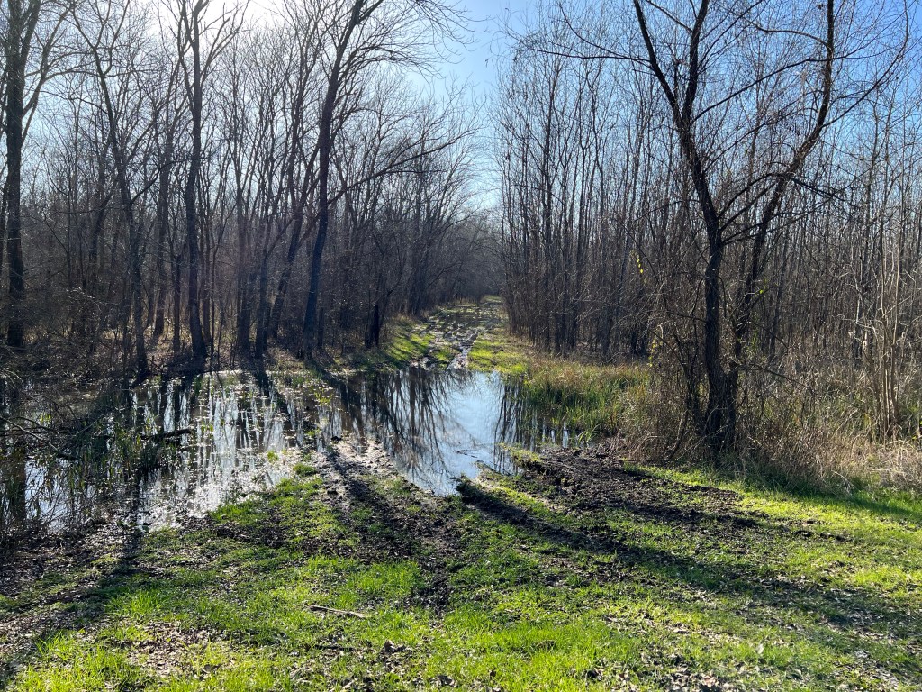
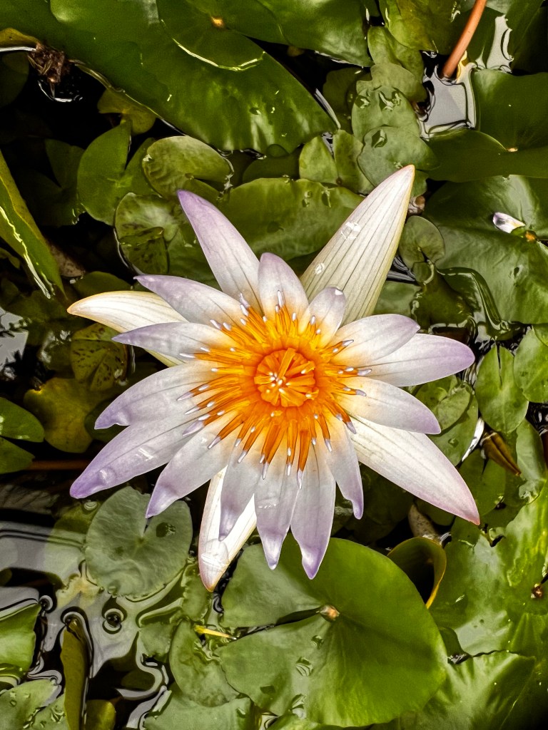
So, when I first arrived in Texas it was freezing… I was so annoyed. But by Sunday it was sunny and 70°F (21°C), which was a perfect excuse to get outside! So we headed to the Mineola Nature Preserve on the Sabine River. Construction on the preserve began in 2002, it encompasses 2,911 acres and it home to native species of animals and plant life. There are hiking trails, mountain bike trails, horseback riding trails, camping, playgrounds, wetlands, woods, and frisbee golf. There’s even a swampy area that they warn you to beware of alligators. We didn’t see a single alligator, but we saw lots of cute turtles sunning themselves.
There’s pretty much something for everyone. We were there just to hike, especially since we had a little one with us. We walked less than I thought we would, but more than my sister thought we would, partly because a couple of trails were waterlogged, so we had to just backtrack rather than making a circuit around the park.
The preserve is actually ranked in the top 15 city parks in the nation for it’s size. I highly recommend checking it out if you happen to find yourself in the piney woods.
Sabine RiverBridge over the Sabine RiverSister and her familyAlligator swampCute turtles in alligator swampMap of the parkTrail through the woods. Built on a railway from the 1800’sFlooded trail
I’m featuring an attraction from a new city! I had the opportunity to meet up with some friends in Austin, TX. One of my former roommates is pregnant with her first baby, so I, along with my other former roomies, traveled to Austin to celebrate the coming baby and reminisce about the old days.
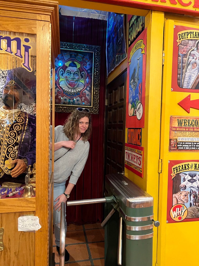
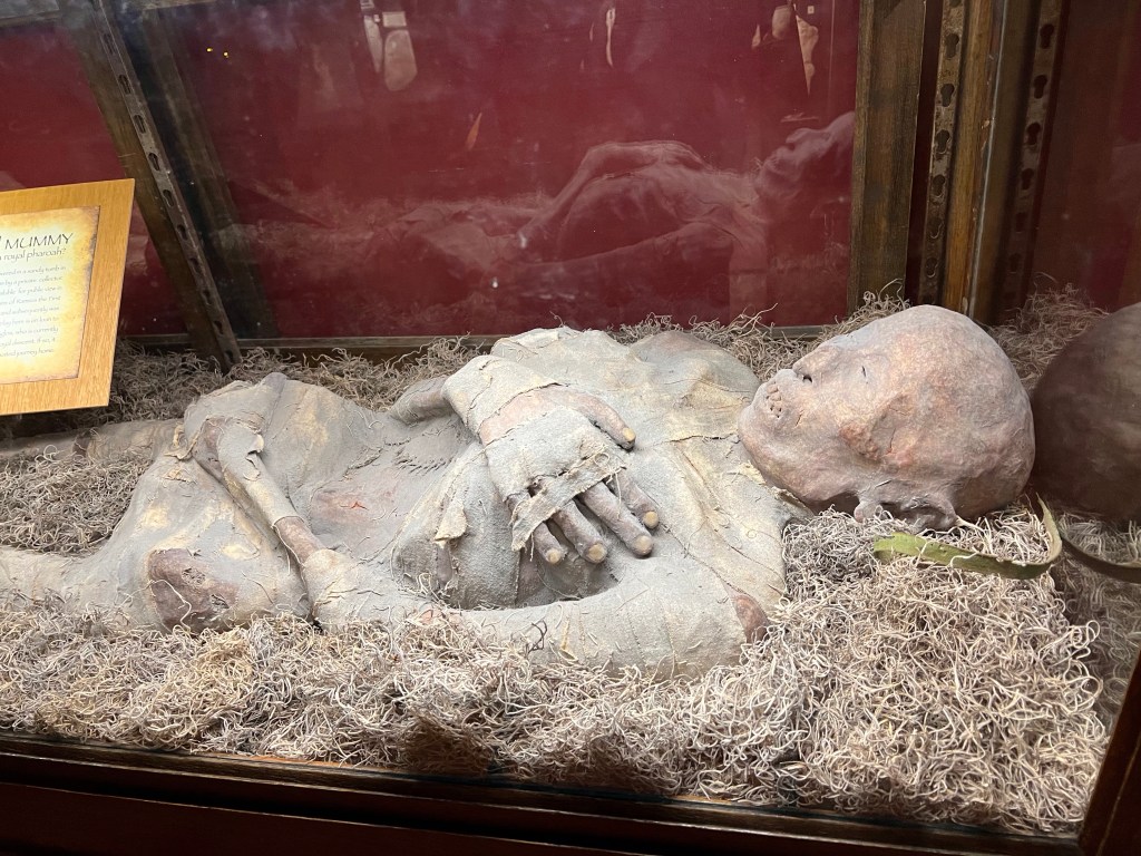
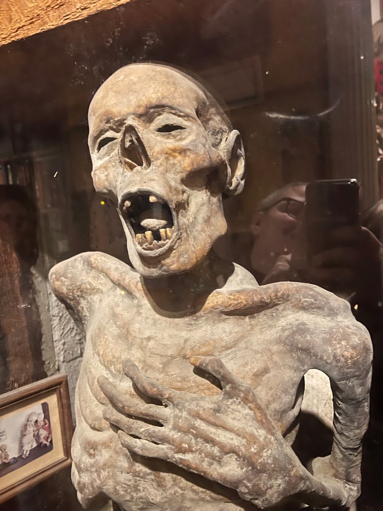
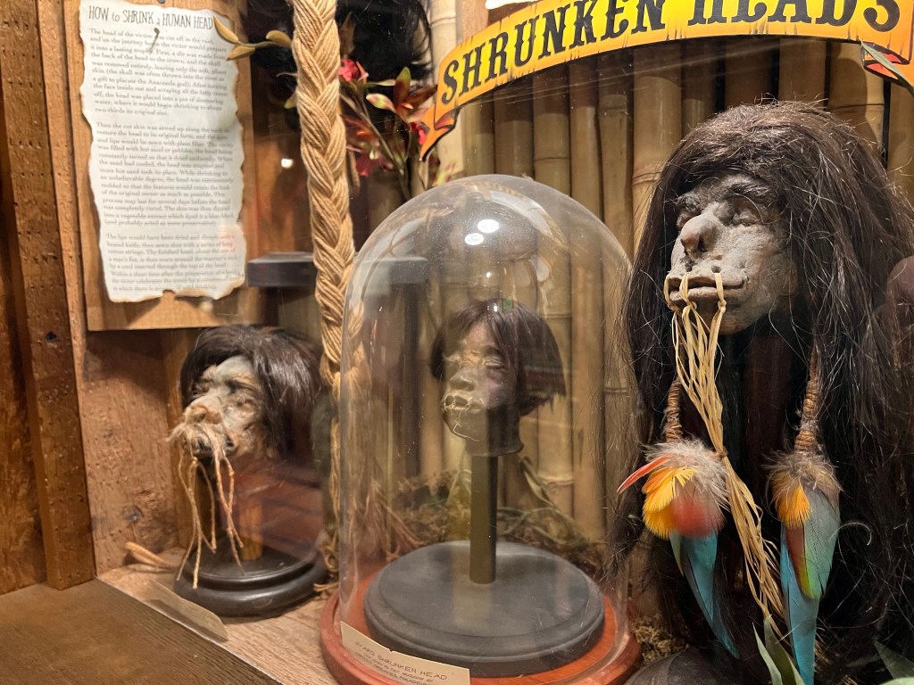
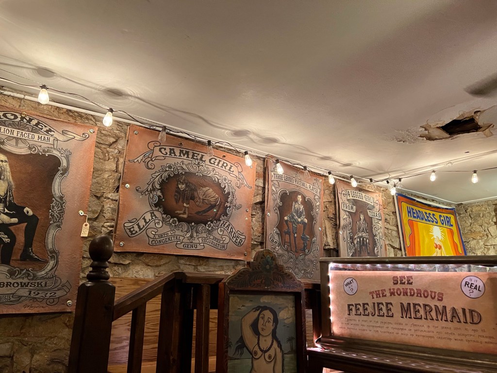
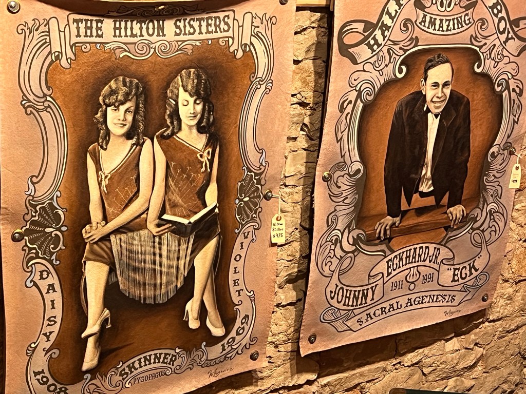
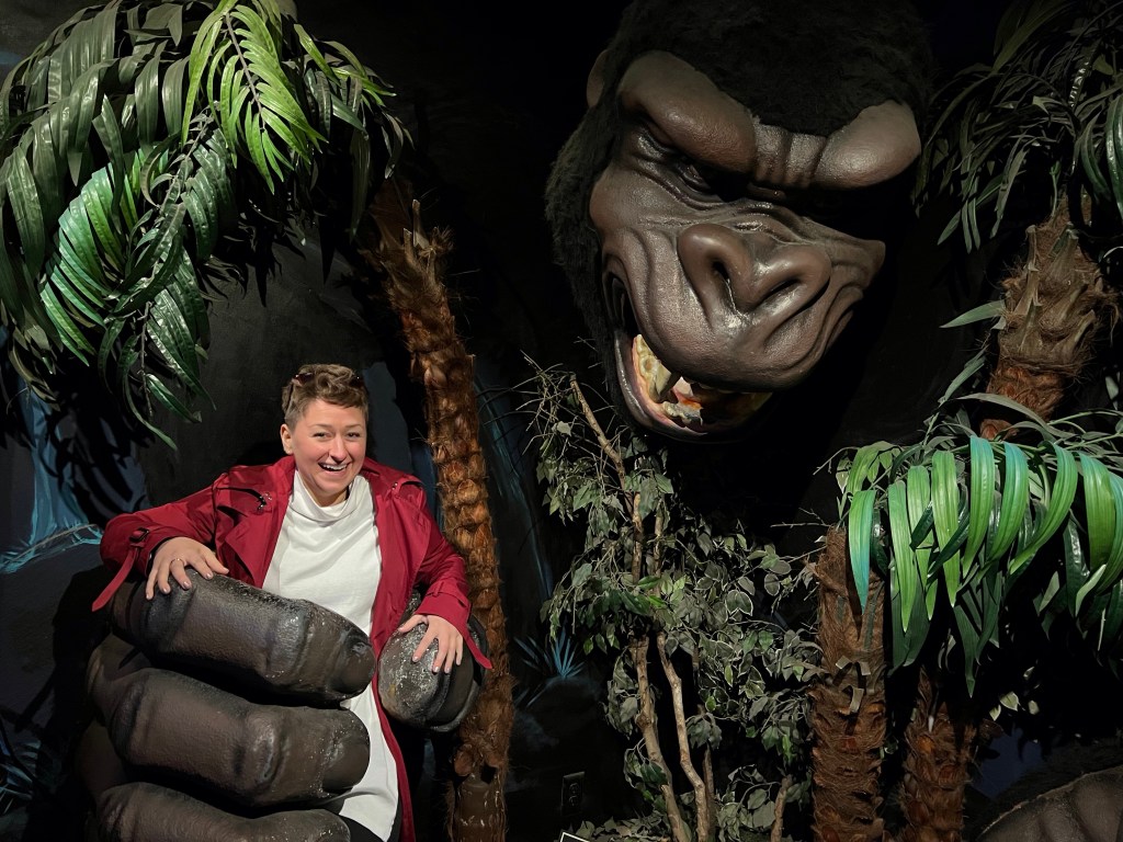
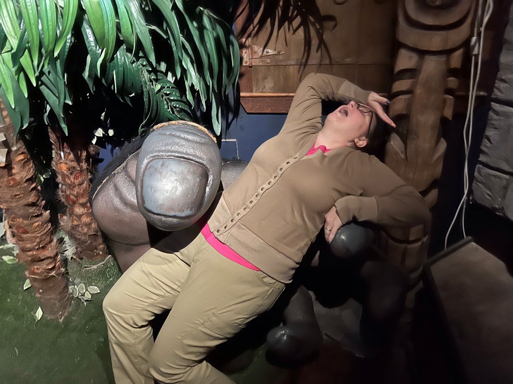
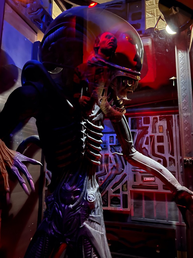
I was excited to be escaping the NY winter and head to Texas for sun and warmth. Alas, Texas had other plans and it was colder in TX than NYC when I arrived on Thursday. Because of the less than ideal weather, we decided to check out an indoor attraction. Austin, much like it’s West Coast counterpart, Portland, prides itself on being “weird.” There are plenty of hipster bars, trendy restaurants, and weirdo donuts, but we decided to lean into the weird and visit the Museum of the Weird. If you’re disturbed by images of mummies or possibly authentic shrunken heads, I don’t recommend viewing the pictures at the end of this post.
The Museum actually started out as a gift shop in 2005, only after they realized that there were items they didn’t really want to part with, and that people enjoyed coming to see some of the oddities displayed, but not buy them, they decided to expand into a museum.
In addition to some authentic items, and some authentically weird items, there’s also a wax museum.
I’m not sure that the attraction is worth the $12.99 price, but it was a fun way to kill a couple of hours, especially if you’re interested in fanciful theories, and curious oddities.
Stella getting ready to experience some weird.A mummy!Another mummyShrunken headsSome vintage postersMore vintage postersStairwell between museum sectionsHanna seemed way less distressed by the massive King Kong than I wasFainting in fear 🤷♀️Alien with a reflection
So last week, I wrote a little bit about the subway system in the city. I’m going to talk about it a little more this week. I had visitors this past weekend (yay for not being all alone while Lewis was in Zimbabwe), and one of these lovely ladies necessitates the use of a wheelchair. This presented a much greater challenge than I anticipated.
First, New York City has a great option for residents with disabilities, it’s called Access-a-Ride. If you are disabled, you can avail yourself of on call vehicles for the same price as a subway ride ($2.75). Also, most buses are accessible. However… and that’s a big however, buses are pretty good within neighborhoods/boroughs, not necessarily for traversing the entire city. And access-a-ride is not available to out of town visitors.
Second, the NYC transit app is completely useless. Google maps, Apple Maps, and CityMapper are great options for navigating the city, but there is no option to search by stations that are handicapped accessible. There is a “quick reference” page (https://new.mta.info/accessibility/stations) that is helpful in identifying stations that are accessible, but it’s definitely not ideal.
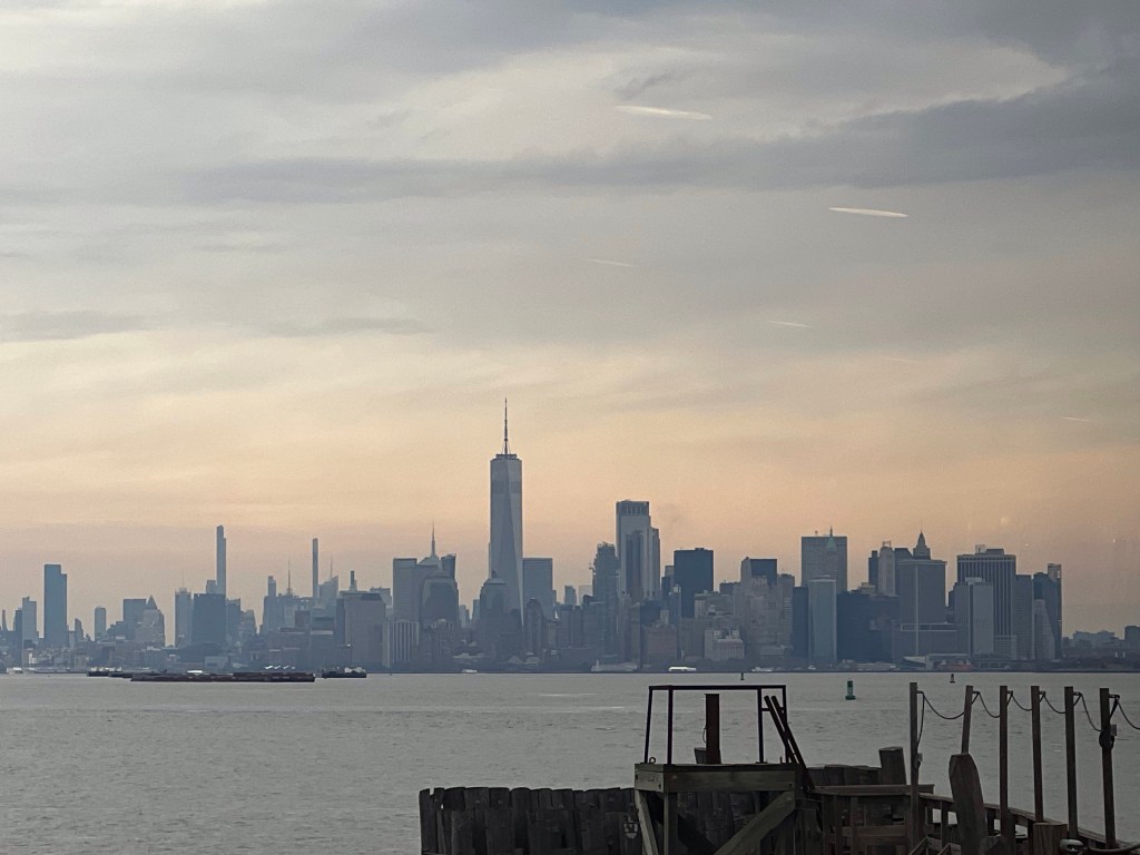
I was trying to get to the Staten Island Ferry from our apartment. The two closest stations to us (Brighton Beach and Sheepshead Bay) are not accessible, so we ordered an accessible Uber to take us to the closest accesible station (Coney Island/Stilwell Avenue). From there we had to go three stations past the Ferry and then we had to walk to the station (which was fine, we did some sightseeing as we made our way south).
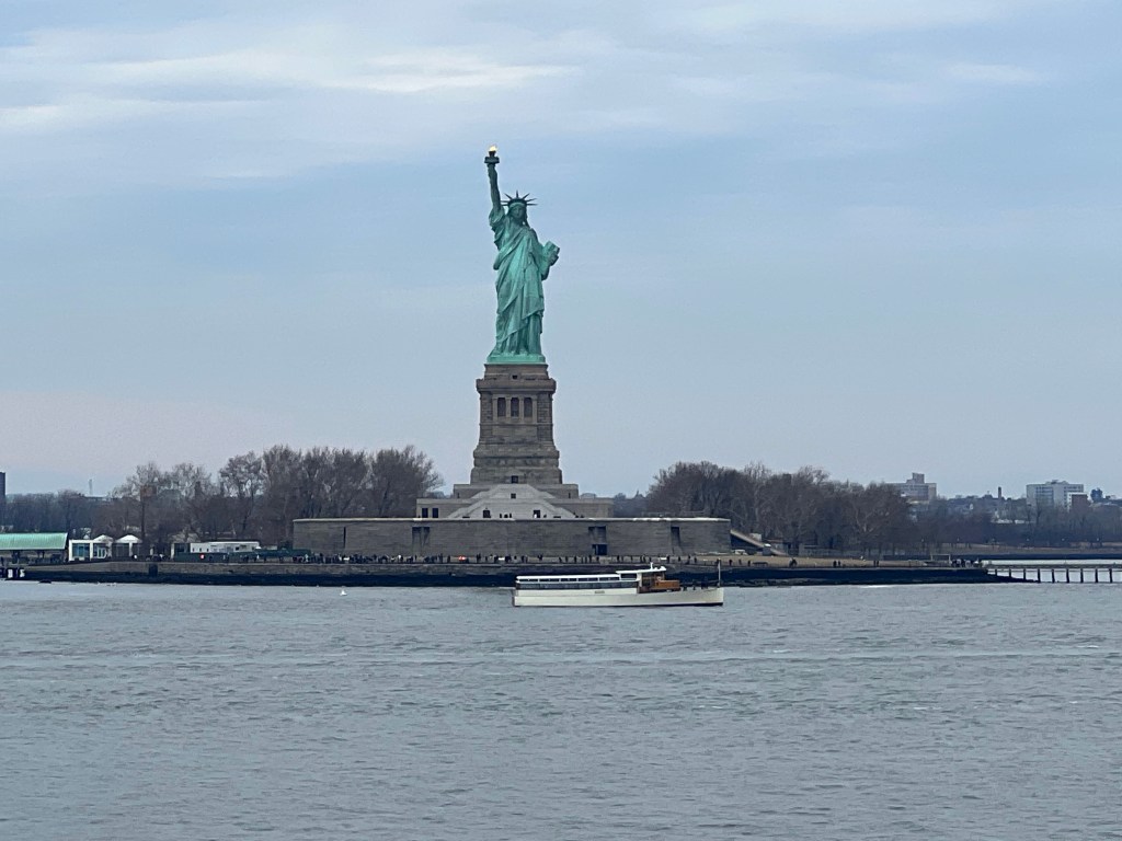
Ferries have serviced Staten Island since at least the 1800’s. The first documented ship was commissioned in 1852 and was a steam paddle wheel boat. Almost all the boats commissioned prior to 1860 were sold to the U.S. Government and put into use for the Civil War.
The Staten Island Ferry is one of the last operating ferry systems in New York. There are four boats that make a total of 117 trips a day. The two best things about the Ferry: it’s free! And it sails right past the Statue of Liberty.
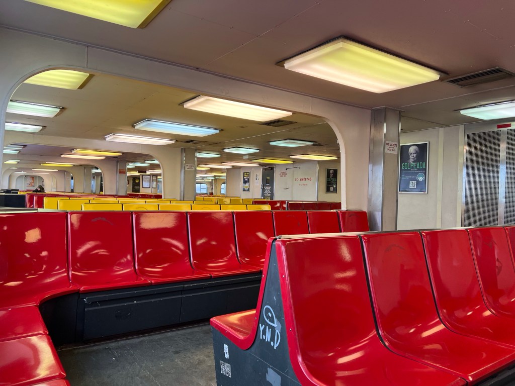
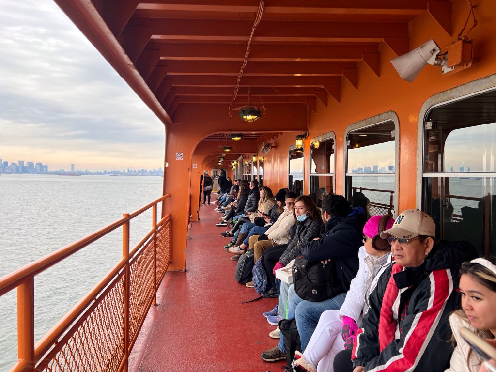
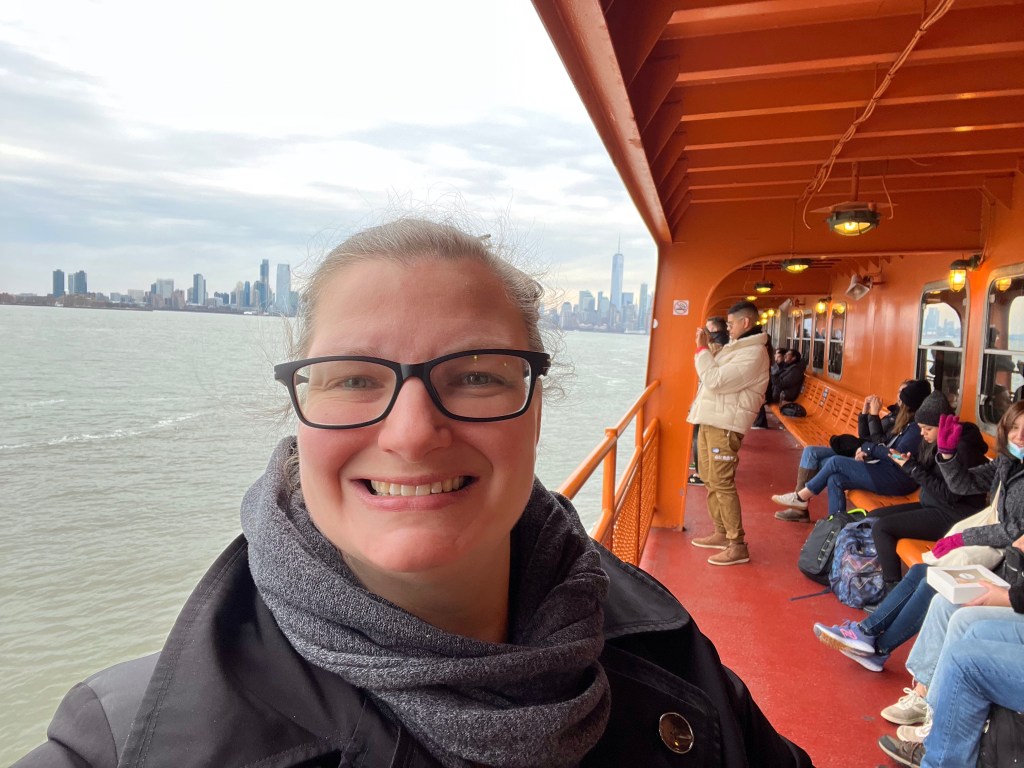
On this particular day it was cloudy and cold, so we stayed inside for the first leg of the trip. On the return trip we rode on the second level and went out on the deck to take photos. You can see some really beautiful views of the city. I love riding the ferry, even when it’s cold. I like the feel of the cold air blowing on my face. I love watching the seagulls fly alongside the boat.
If you get a chance to visit this iconic attractions, it’s worth the fifty minute investment of time.
I had Monday off this week, and an extra day off is a perfect excuse to head out for another installment of Tourist Tuesdays.
Lewis is out of town for work right now (he’s in Zimbabwe finalizing some details of the purchase of some land for the congregation there), so I had to head out alone.
Whenever I do anything alone (driving, grocery shopping, taking the subway) I always feel more grown up… to be clear, I’m quite obviously a middle aged woman, but I don’t feel like a grownup. It sneaks up on you kids, one minute you’re a young adult trying to figure life out, the next you’re on the other side of “over-the-hill” wondering how the heck you got there. So anyway, I always feel like a grownup when I take the subway by myself.
Some things to know about the subway. In Manhattan it is fully subterranean, but when you get to the outer boroughs (Brooklyn, Queens, the Bronx) some of the lines are subterranean, but other parts of the lines are elevated, but it’s still the same system. So, when we have visitors we’ll tell them to catch the subway at the such and such stop and they get confused because it’s elevated. Don’t ask me, I didn’t design the system.
I don’t know how people navigated the subway before smartphones and GPS. I mean, I know the lines in my neighborhood, and how to get to lots of places in the city without using GPS, but going outside of those very specific train lines gets very confusing. Apple Maps works quite well, Google Maps also. I like to use CityMapper, it tells you what part of the train to sit on so it’s easier to access transfers or exits.
Also, the subway is relatively cheap to ride, it’s $2.75 no matter where you are going in the city. Southern Brooklyn (where we live) to northern Bronx, still $2.75. Need to transfer to multiples lines to get where you’re going? As long as you don’t leave the station, still just $2.75. And if you take more than 12 rides in a week (using the same credit card) every ride after that for the week is free.
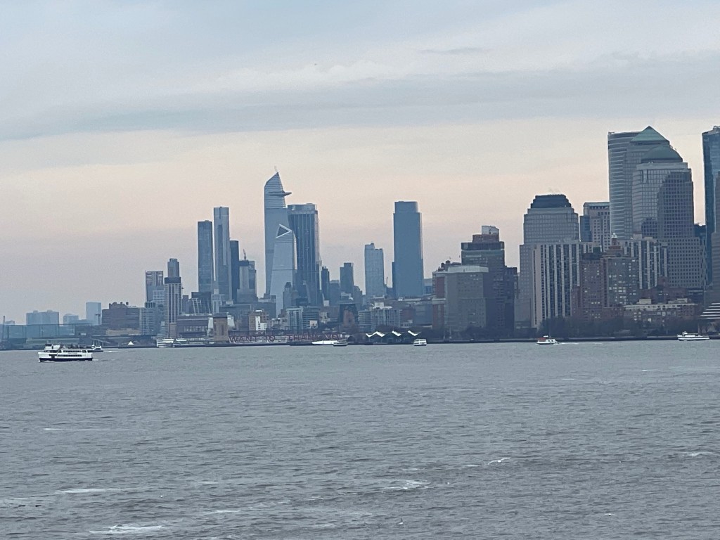
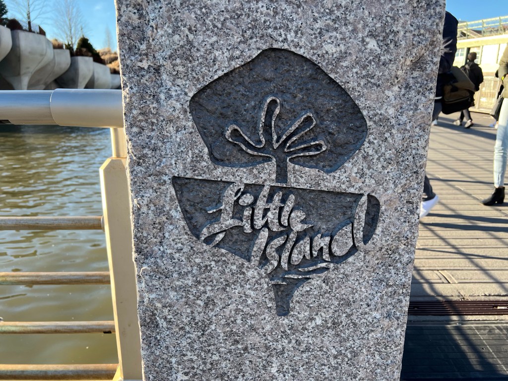
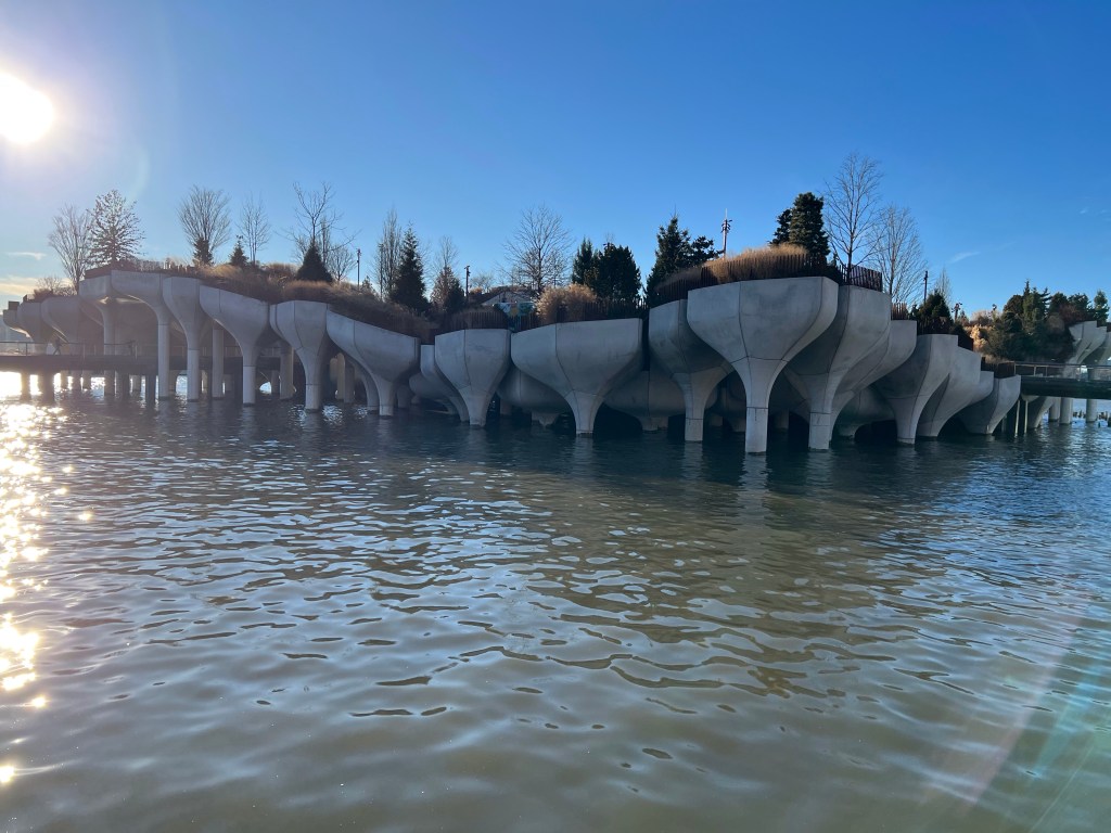
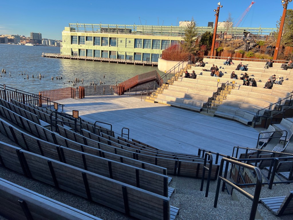
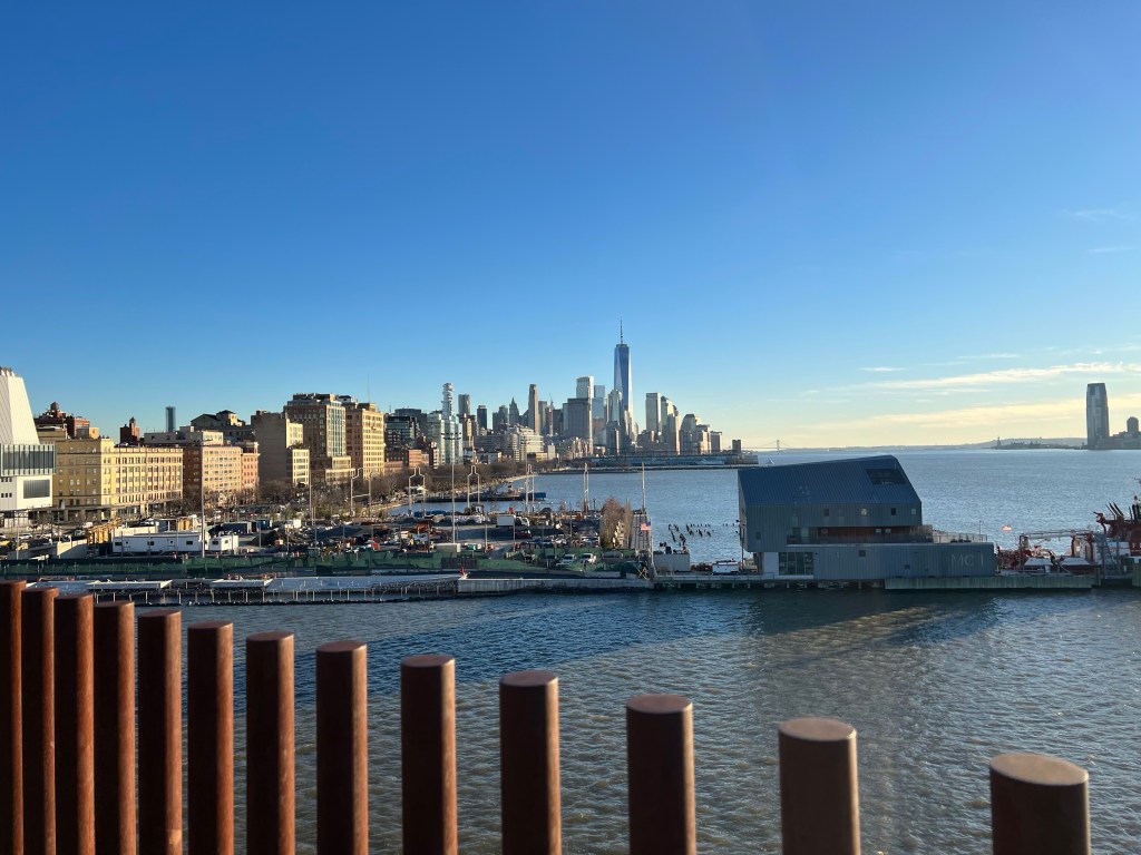
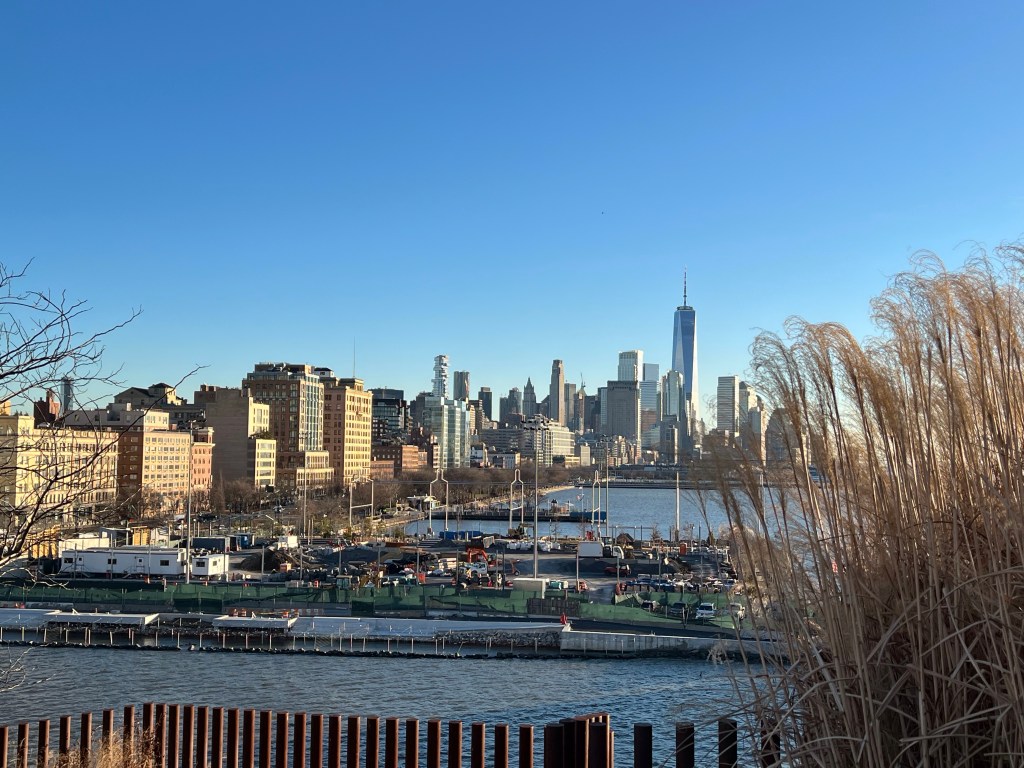
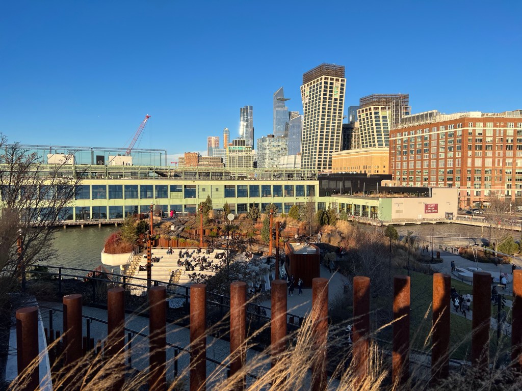
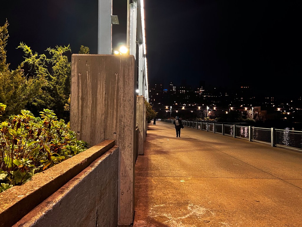
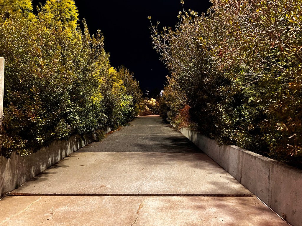
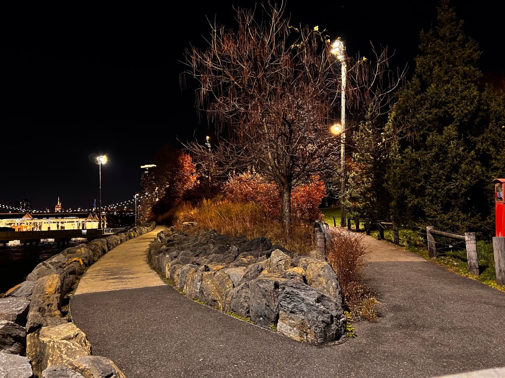
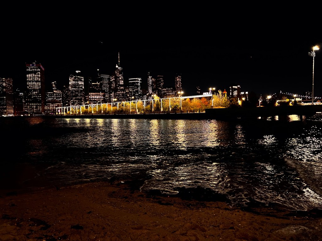
So enough about the subway already! For Tourist Tuesday I caught the B train to Manhattan, with a transfer to the D to the Meatpacking district (just south of Chelsea and northwest of the West Village) to visit Little Island.
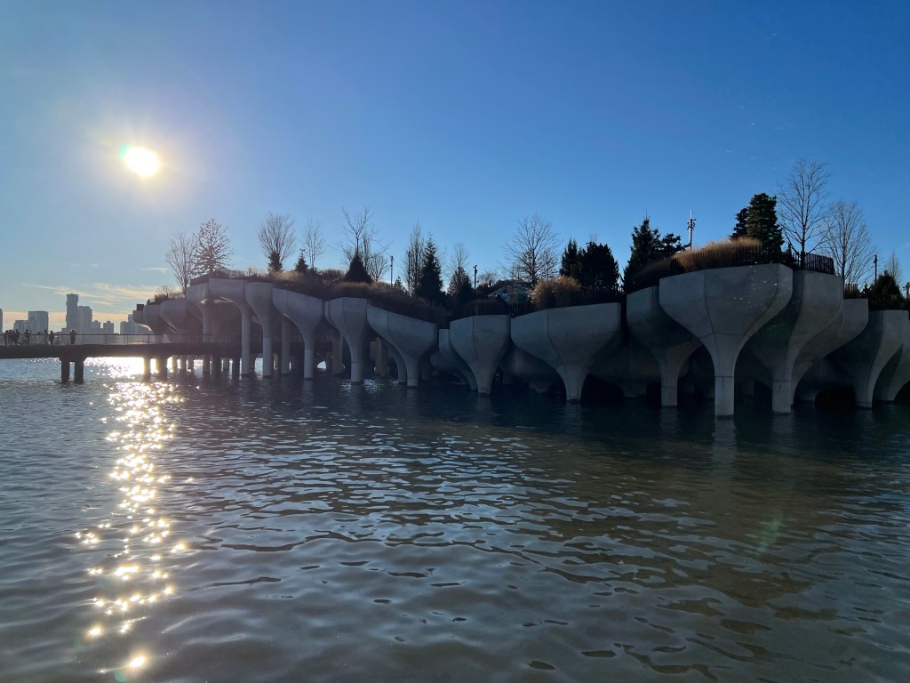
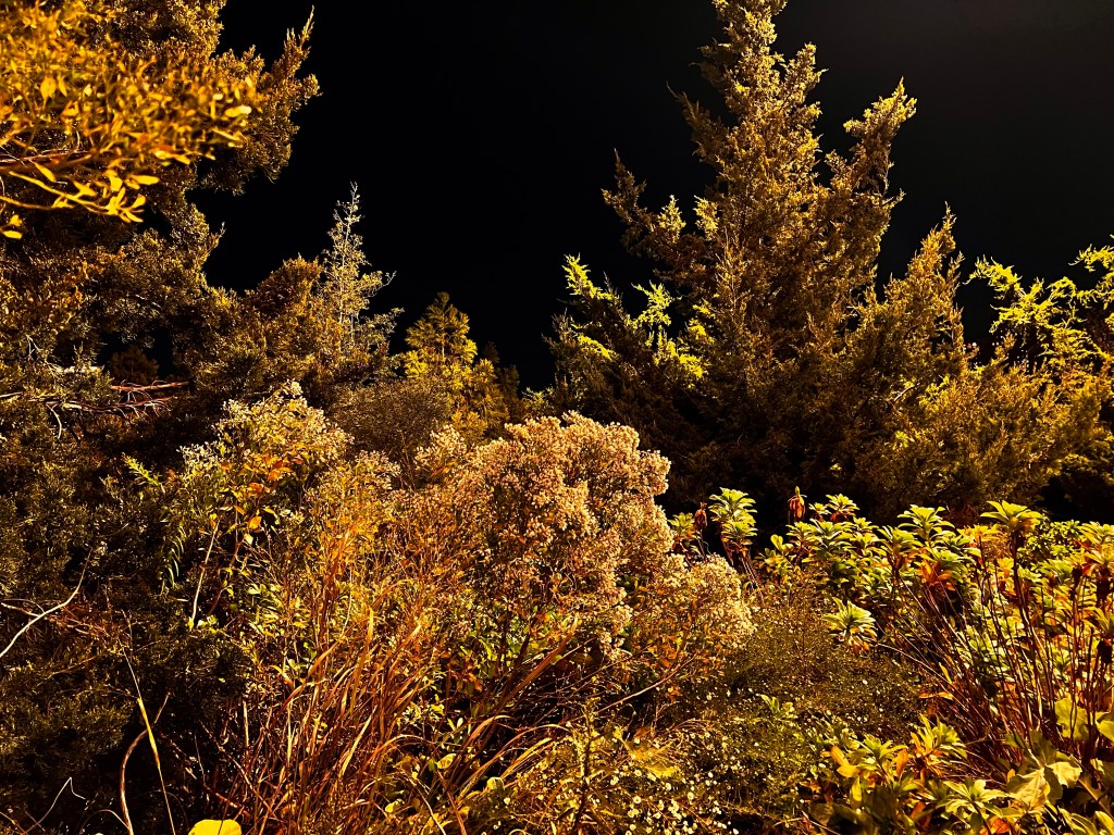
Little Island is a new park in NYC that opened in May 2021. But the area, like most places in the city, has a long history. Built on the Hudson River, this area of the Meatpacking district has been been a busy port of entry and/or trade dating back to the early colonization of the area with the Lenape tribe using the area as a seasonal encampment for hunting, fishing, and trade along the river. Multiple piers up and down the river were establish in the 19th and 20th centuries. Pier 54 (the site of Little Island) operated the British Cunard-White Star line. The Titanic was supposed to make port at Pier 54, instead the survivors arrived aboard the RMS Carpathia rescue liner. Just three years later the RMS Lusitania departed from Pier 54, only to be sunk off the coast of Ireland five days later. Because of this, superstitious people claim that the pier is cursed.
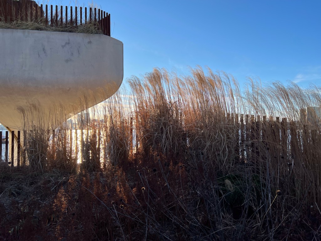
In 2012 Hurricane Sandy hit NYC, leaving heavy damage in her wake, including Pier 54. In 2013 the Hudson River Park Trust partnered with the Diller-von Furstenberg Family Foundation to begin development on a whole new kind of park. The park is literally built in the river; comprised of 132 “tulip pots” (giant columns with bowls at the top sunk into the river to form the base of the park). The park covers 2.4 acres filled with trees, shrubs, grasses, and bulbs. There’s an amphitheater, trails, tables and chairs, in the summer there are a couple of food trucks, and some benches scattered about.
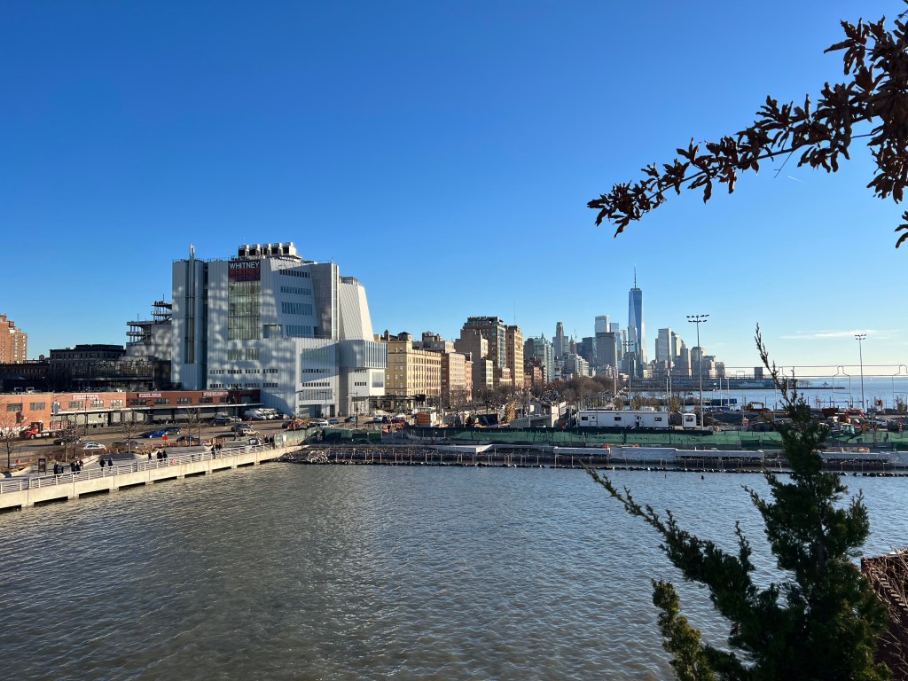
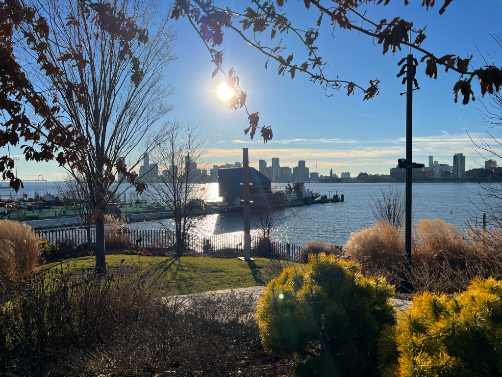
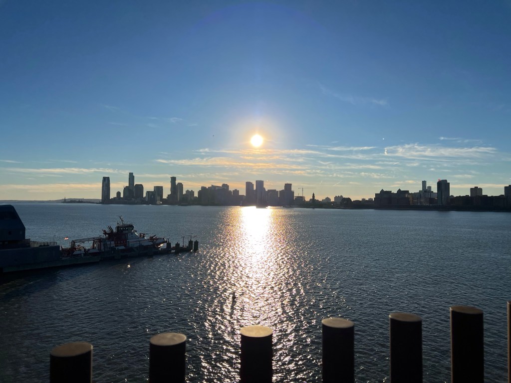
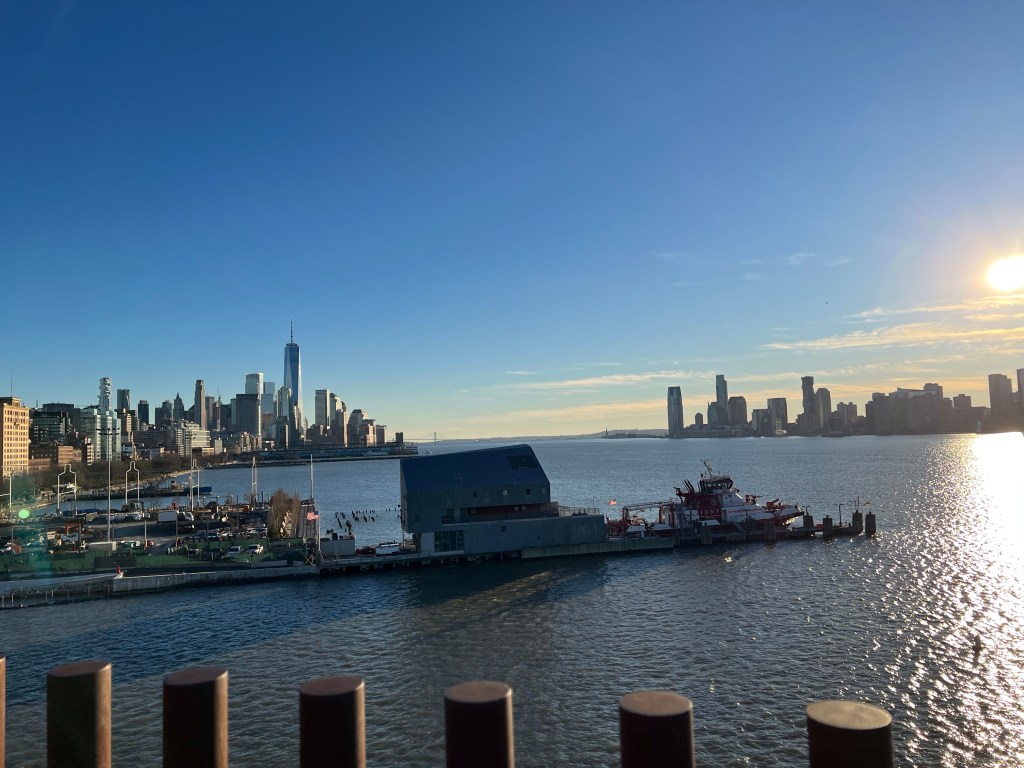
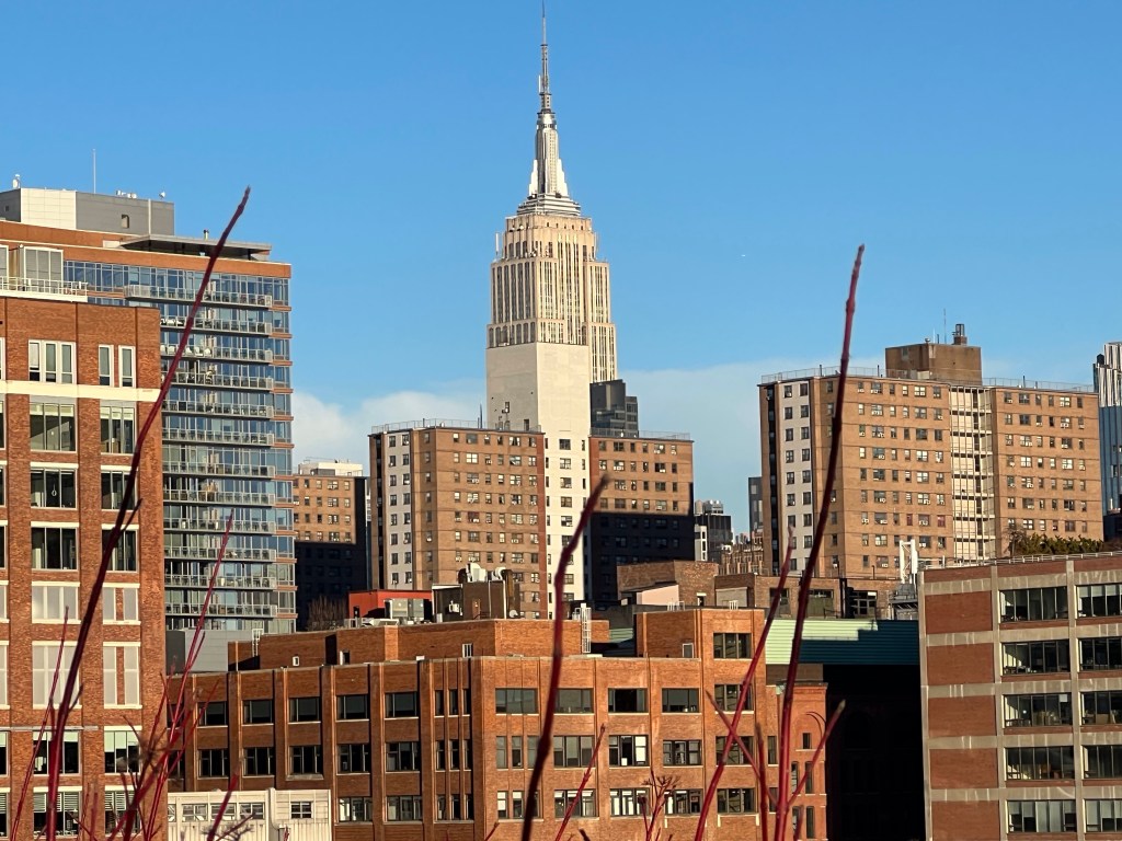
The park has fantastic views of the river, New Jersey, and Manhattan (you can see the Empire State Building and One World Trade Center from the park).
I highly recommend checking out the park, but be prepared for big crowds, especially when it’s warm… really any time that it’s sunny, there’s going to be a crowd. Personally, I love the river when it’s foggy and overcast, it’s magical to see the fog floating over the river, shrouding the buildings mist. On this day it was incredibly sunny. I’ll try to post photos from the park when it’s foggy if I ever get the chance. The park is free, and opens at 6 a.m. Closing time varies throughout the year.
Have I mentioned I love my neighborhood? I think it bears repeating, I love my neighborhood. This week’s installment of Tourist Tuesday once again features a hidden gem in my own neighborhood. We live between Brighton Beach (highlighted here: https://landlshenanigans.com/2022/12/20/tourist-tuesdays-brighton-beach/) and Sheepshead Bay.
Known to be a fishing village in pre-colonial times, in the early 1900’s it had developed into a yacht club haven. The tradition of sailing and boating in the bay continues to this day.
Along the north side of the bay you’ll find a row of restaurants and fishing charters. It’s always vibrant and thrumming with life. Along the south side of the bay are ridiculously expensive homes, with the peninsula terminating in the Kingsborough Community College. A pedestrian bridge connecting these two sides of the bay was first built in 1880.
But at the top of the bay sits a beautiful and sobering tribute; a Holocaust Memorial. In the Spring and Summer the area feels almost secluded with trees and foliage forming a barrier around the memorial from the car and foot traffic surrounding it. In the late Fall and early Winter the ground plants get cut down, giving a more open view of the beautiful memorial. Conceived in 1986, the park was officially dedicated in 1997.
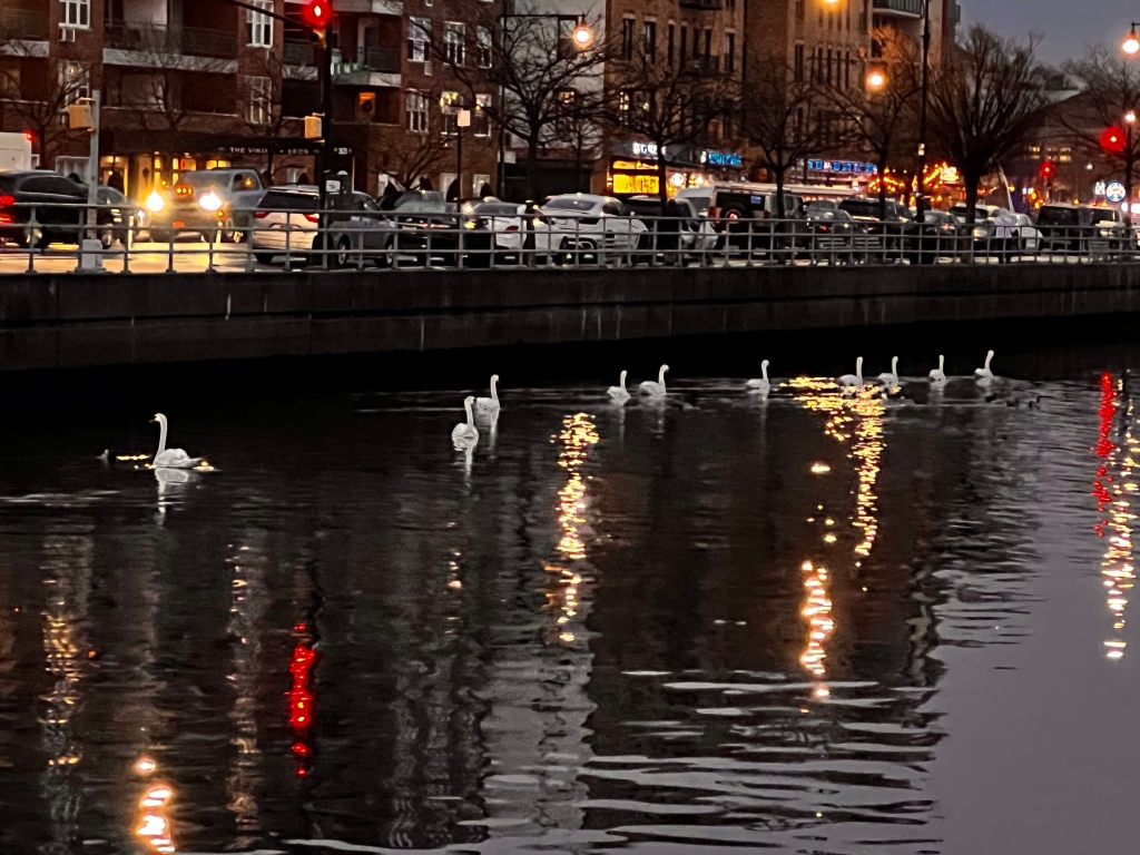
It’s worth a visit if you can make it to the neighborhood, and if you’re a bit peckish after your visit there are tons of restaurants to choose from along Emmons Avenue (burgers, bakeries, Turkish, crepes… pretty much anything you can think of). Also! There are swans in the bay! They’re beautiful and peaceful to watch.
Since I’m actually headed out of town this week, I decided to stay a little closer to home for this week’s installment of Tourist Tuesday.
So, we live between the neighborhoods of Brighton Beach and Sheepshead Bay. I love our neighborhood. It’s relatively quiet… I mean, as quiet as a New York City neighborhood gets. Our apartment is within walking distance of two train stations, the beach, grocery stores, and restaurants.
Once characterized by the New York Times as the “grumpy neighbor” of Coney Island, Brighton Beach is a small mostly Russian neighborhood (it’s also known as “Little Odessa,”) though the demographics have shifted some in recent years, with more immigrants settling from the Middle East and Asian countries.
Until 1868 the area was mostly farmland, but William A Engeman purchasable 39 lots and converted the area into a resort. By 1919 the demographics of the area had shifted such, that most in the neighborhood were first or second-generation Jewish Americans; this number only grew from the influx of Holocaust survivors that settled in the area.
In the 1980’s a new influx of immigrants began to arrive from Russia, transforming the neighborhood from a primarily Jewish neighborhood to a Russian neighborhood.
As for my visit to Brighton Beach, the beach itself is pretty quiet in the wintertime, but the scenery is no less captivating. The beach is a great place to go to escape the overcrowded city streets.
I recently read an article that designated NYC (tied with Singapore) as the most expensive city to live in… yay for winning! And seriously, a lot of things are really expensive (housing, food, fuel, tolls, parking, entertainment… I think that covers just about everything), however…, big ol’ however, there are some things you can find to do for free sometimes.
We’ve lived in NYC for almost five years (our five-year anniversary is in February) and we have never stepped foot in the Botanic Garden. Partly because time, but partly because money. It’s $18 per adult, which isn’t crazy, but I can walk to the beach for free or take the subway and visit Central Park for free… there are just a lot of free options around
People have been encouraging us to go since we got here. Well, we recently discovered that we can get “affiliate” tickets to some attractions for free with our library card through the Culture Pass. They don’t make it particularly easy, and some of them are limited to once a calendar year, but FREE! YES! And the Brooklyn Botanic Garden is one of those attractions. So you have to reserve the ticket through the library, and then you have to use that ticket to purchase a ticket from the attraction. Also, and I’m going to bold this for any of the New Yorkers that might be reading this and don’t know, the culture pass ticket will indicate that you reserve for a specific day, but you can use the tickets anytime in a 30-day period, this is a lie! You HAVE TO USE THE TICKETS ON THE SPECIFIC DAY. We learned this the hard way when we arrived and they wouldn’t honor my husband’s tickets. He had made a reservation for him and his mom on one day, and then realized we weren’t going to be able to go on that day, so when I got my ticket I booked it for the right day. So we had two tickets they wouldn’t honor and two tickets that they would. It was confusing but worked out okay in the end.
Obviously, a botanic garden is going to be more exciting in the spring and summer, and maybe the fall with the leaves changing color, but don’t let that deter you from visiting in the winter, there is still plenty of beautiful things to see in the winter (but I will for sure be back in the springtime… I want to see the cherry blossoms).
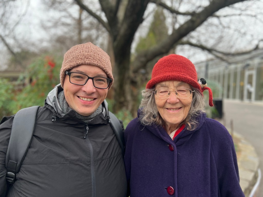
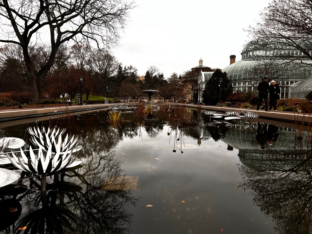
So, on a chilly, rainy Sunday morning we headed off to the Brooklyn Botanic Garden. Since it was raining and we had my mother-in-law with us we decided to drive rather than take the subway. Traffic wasn’t terrible and there is a paid parking lot right next door (shared with the Brooklyn museum). We paid just over $10 for around three hours. Which is super cheap parking in the city.
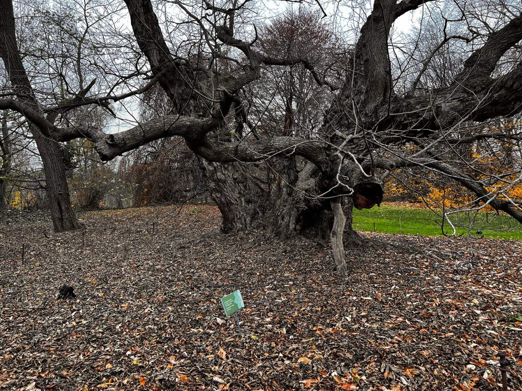
The Brooklyn Botanic Garden is comprised of 52 acres and officially opened in 1911 with native plants being the first display created.
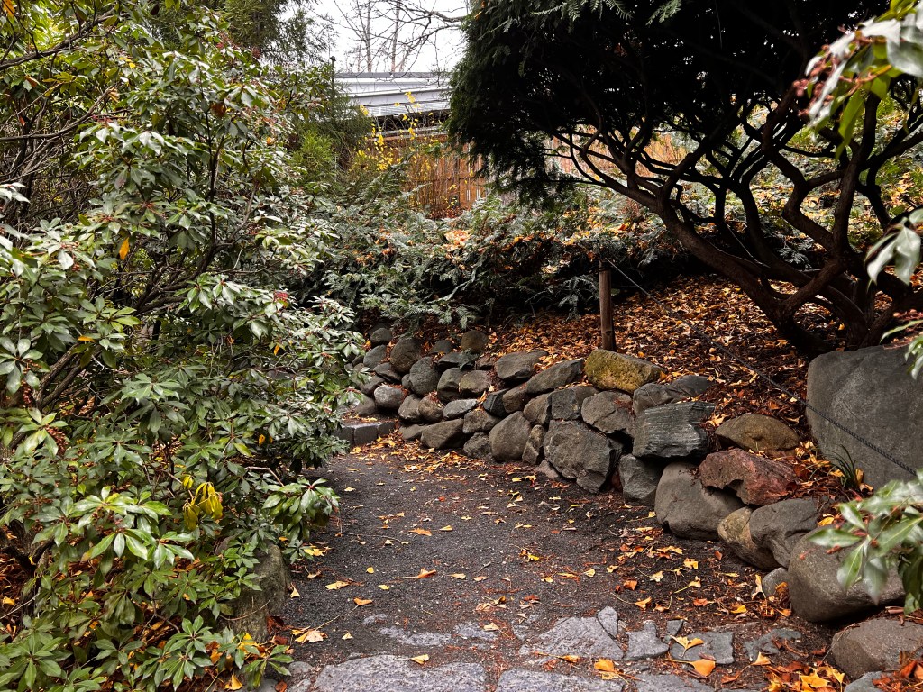
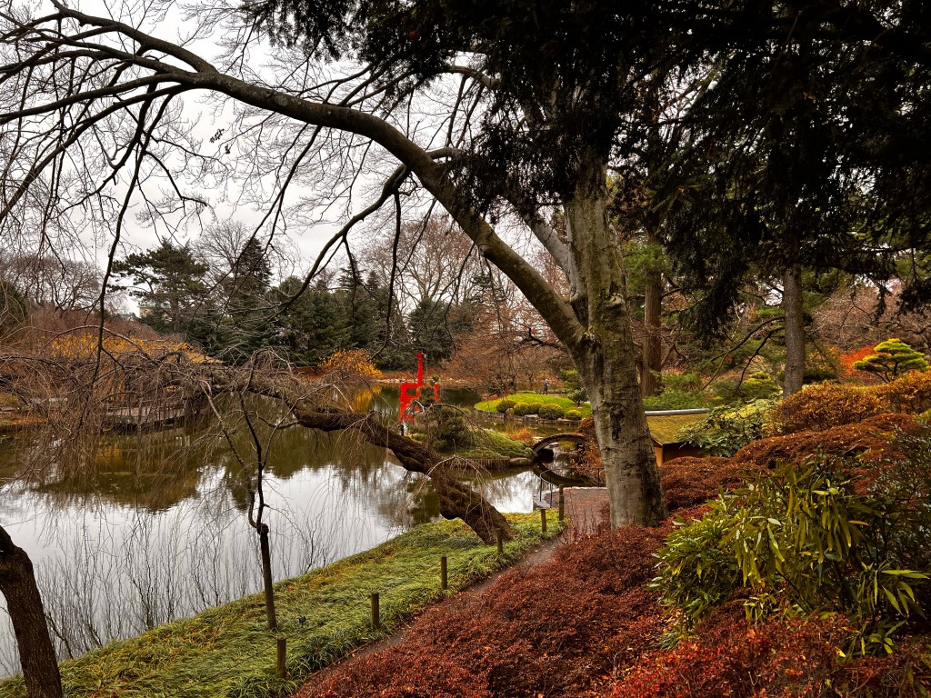
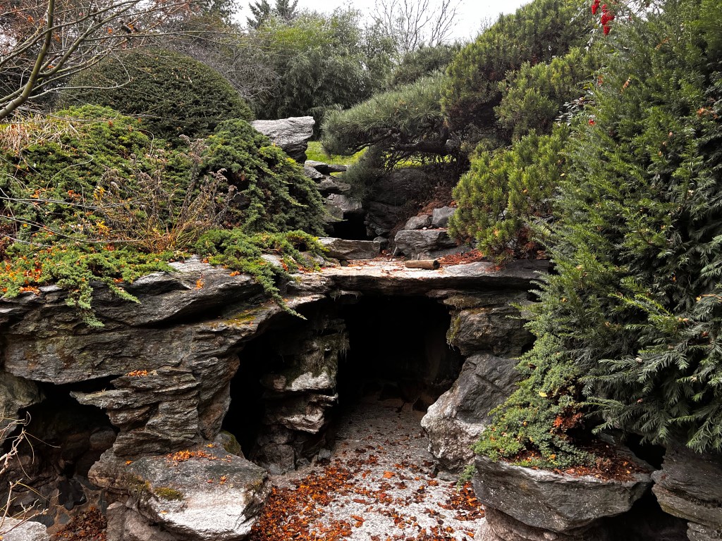
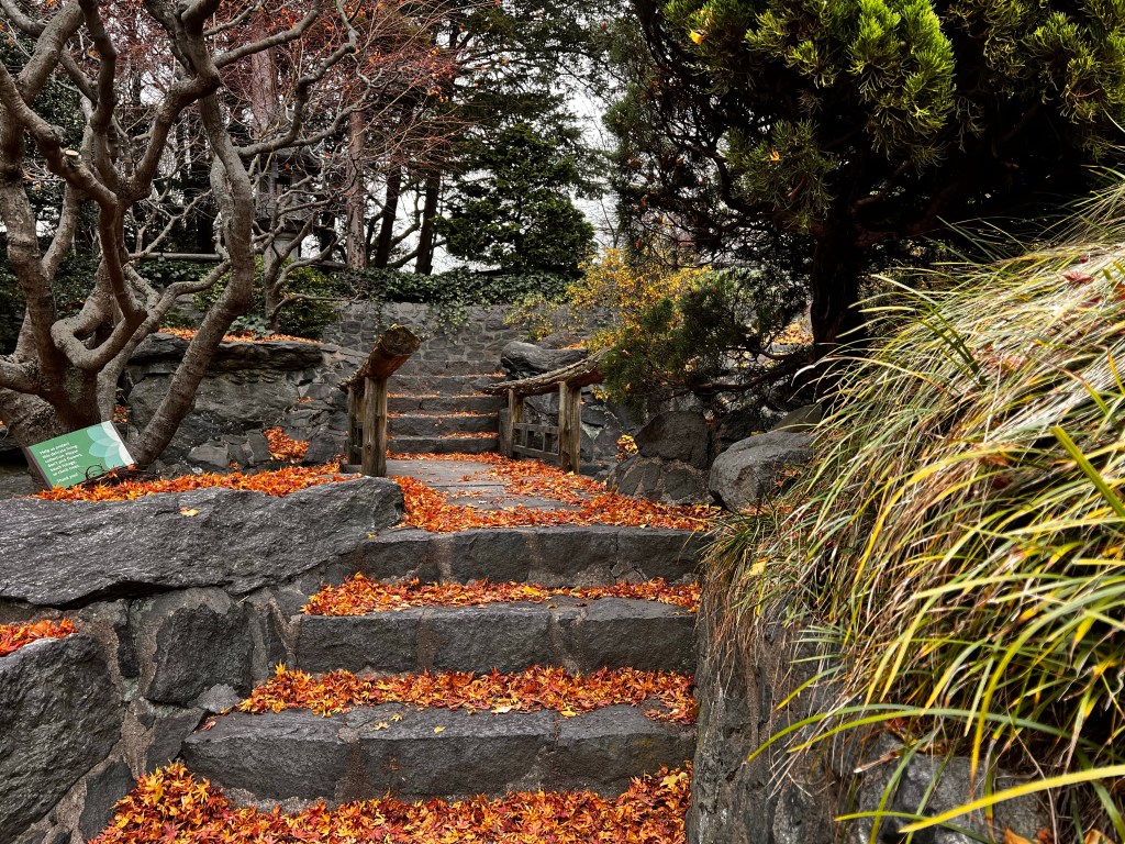
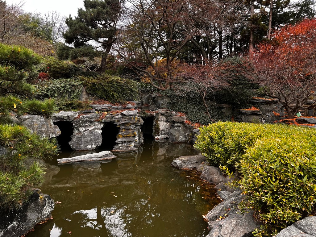
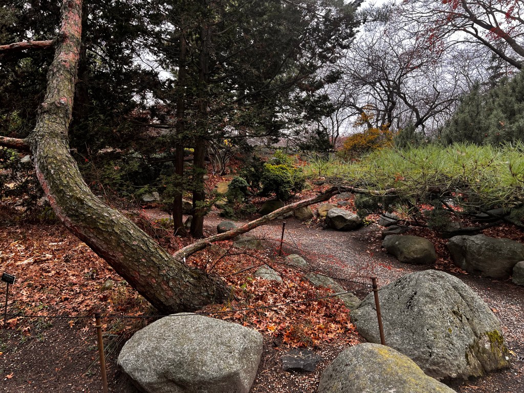
The Japanese Hill-and-Pond Garden is one of the first stops in the garden, the design was completed in 1915 making it one of the first public Japanese gardens in the U.S. (it’s one of the oldest outside of Japan), and it is a lovely, peaceful place to sit and enjoy being in nature. The area is wooded with evergreen trees (cedar trees, Japanese white pine, eastern white pine, Japanese red pine), and lots of maple and cherry trees.
The Cherry Esplanade was closed, and we skipped the rose garden since there aren’t any roses this time of year (seriously, I can’t wait to go back in the spring) so we walked through the Rock Garden. There were some lovely trees and lots of plants to enjoy, but I was a little disappointed in the rock portion of this garden. I love rocks, so I was hoping for a big variety, with lots of identification tags, but alas, just a few were identified, it was mostly trees and plants around some boulders.
The Herb Garden, on the other hand, was fabulous; tons of plants with descriptions along with the medicinal uses of the plants or historical origins/uses. Granted, a lot of the plants were cut down for the winter, but the identifications were still there!
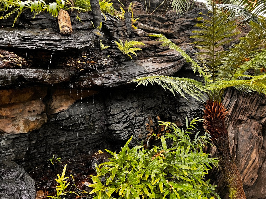
At this point, it was cold and rainy and we were in need of a bathroom break, so we cut through the Water Garden to go to the Steinhardt Conservatory. The conservatory was completed in 1988 and its collections are amazing. I feel like I’m using a lot of superlatives, but really, if you enjoy outdoor spaces or plants, it’s hard not to geek out over all the things.
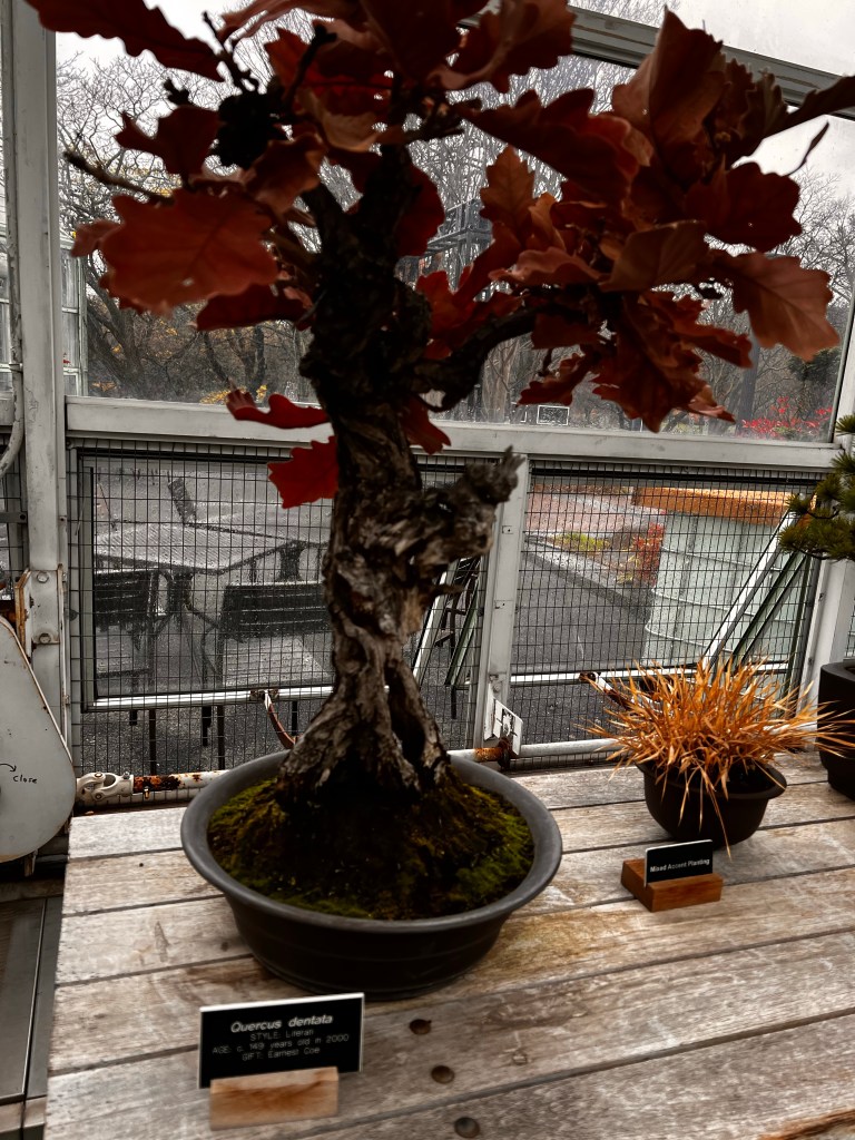
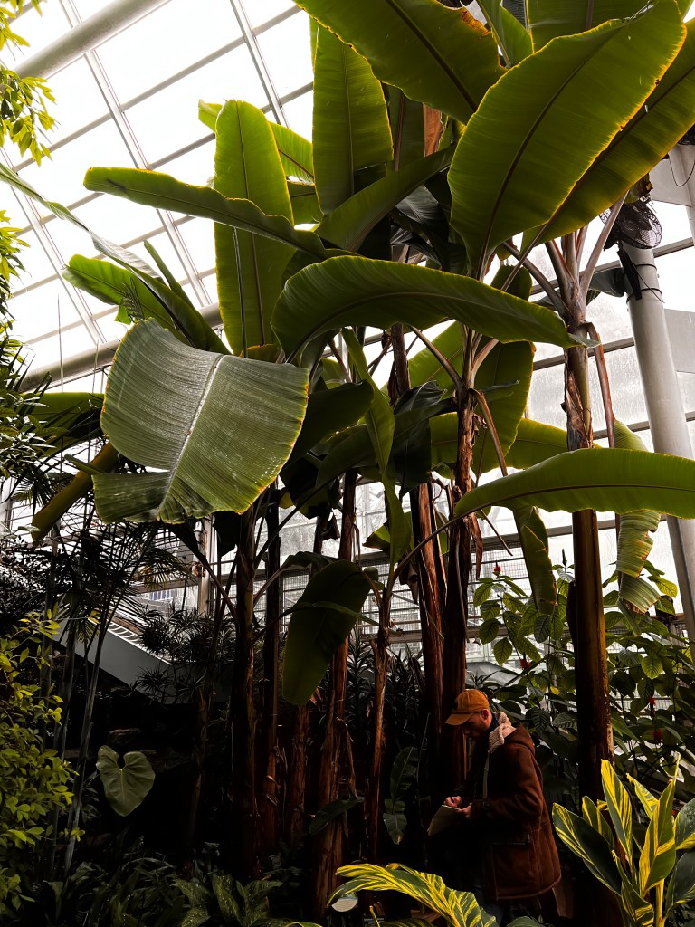
The conservatory is made up of six areas. The Trail of Plant Evolution is on the main level; the room is warm and brimming with plants from all over, including a baby Baobab tree from Africa. Baobab trees have a spot in my heart from my time in Malawi. They’re stunning majestic trees, and how they survive drought conditions is rather marvelous (they are a “stem-succulent” tree and they store water in their stems [trunks] https://nph.onlinelibrary.wiley.com/doi/full/10.1111/j.1469-8137.2005.01618.x). Also on the main level is the Bonsai Museum. I’ve been fascinated by bonsai since I was a little kid; I still have the book my mom bought me when I was ten on how to grow bonsai, it’s a cheesy book written in the 70’s, but I love it. Across from the Bonsai Museum is the Warm Temperate Pavilion… I’m not saying it was boring, but I just saw the place a day ago and I can’t really remember what the room was like.
The downstairs pavilions include the Aquatic House and Orchid Collection, the Desert Pavillion, and the Tropical Pavilion. I could live in these rooms. There is something so special about being surrounded by so many plants. The air in each of the pavilions is conditioned specifically to support the plant life… humidity levels, air circulation, temperature, and the air just felt good, like you could breathe more deeply.
10/10 go visit the Brooklyn Botanic Gardens any time of year. I’ll probably post an update when I go in the spring or summer.
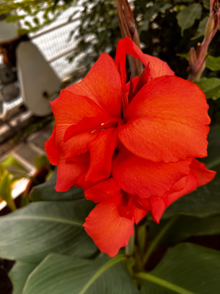
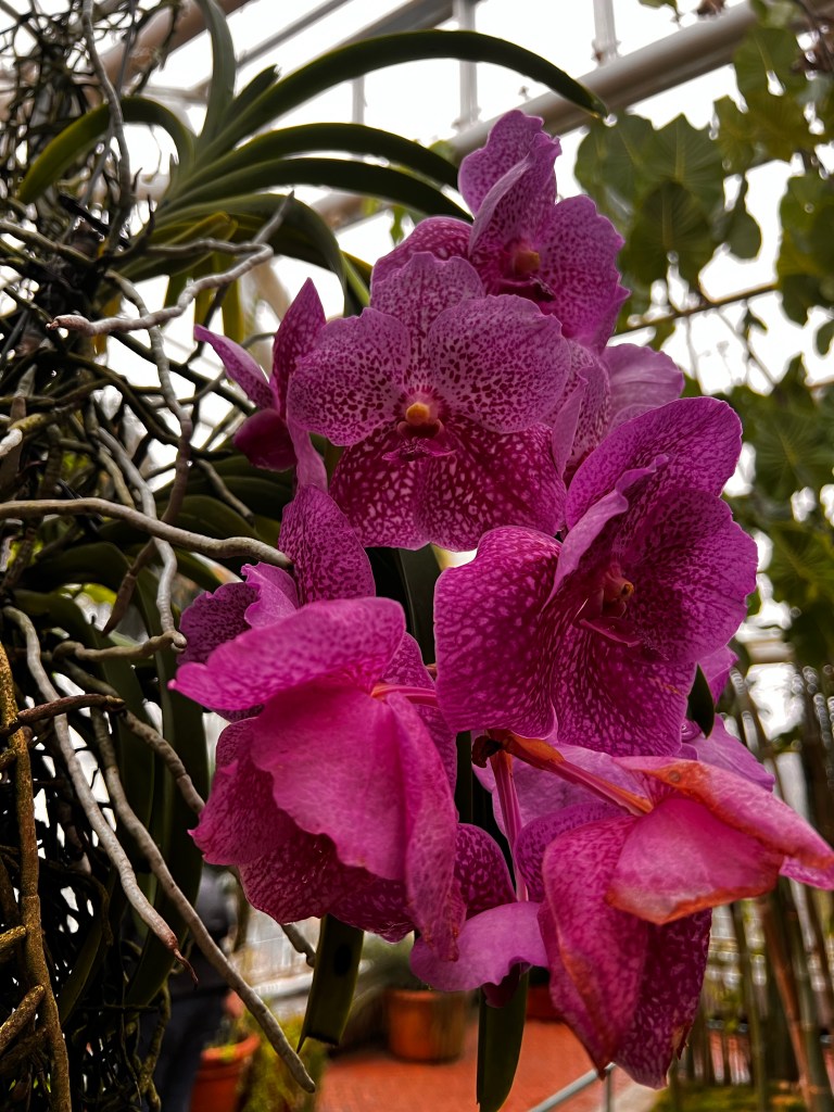
Lewis and his mom, Nancypond in the Japanese gardenPath in the Japanese GardenYellow Crane Flowera red banana tree…man at the base for scaleMexican pincushionShakespeare GardenDaubeney’s Water Lily
So, I am not a native New Yorker. I grew up in a relatively small city in Northern California (Chico https://chico.ca.us) and spent my teen years in a small suburb in Northeast Ohio (Cuyahoga Falls https://www.cityofcf.com). I’m not a country girl, but maybe country adjacent? Regardless, I am not a city girl at heart. I’m used to lawns and gardens, forests and wilderness. None of which are particularly plentiful in New York City.
That being said, I’m extraordinarily appreciative of the fact that NYC does it’s best to cultivate and utilize green spaces. Given my propensity for being outdoors, I’m sure a number of my Tourist Tuesday posts will feature one of the many beautiful parks or outdoor spaces around the city.
On Monday evenings (at 7:30pm) my wonderful husband broadcasts a Bible study live on YouTube (https://m.youtube.com/c/ucgnyc/live). He loves to hit the road and broadcast from outdoors. So I joined him for a trek to Brooklyn Bridge Park.
We chose to drive to the park this trip, as we can usually find parking in the colder weather months, especially in the evening. Don’t bother trying to park in the warmer months, it’s nearly impossible. You can also get to the park by subway, but be prepared for a mile or so walk once you get off the train. Also, pay attention to the hours of the different piers; some of them close earlier than others.
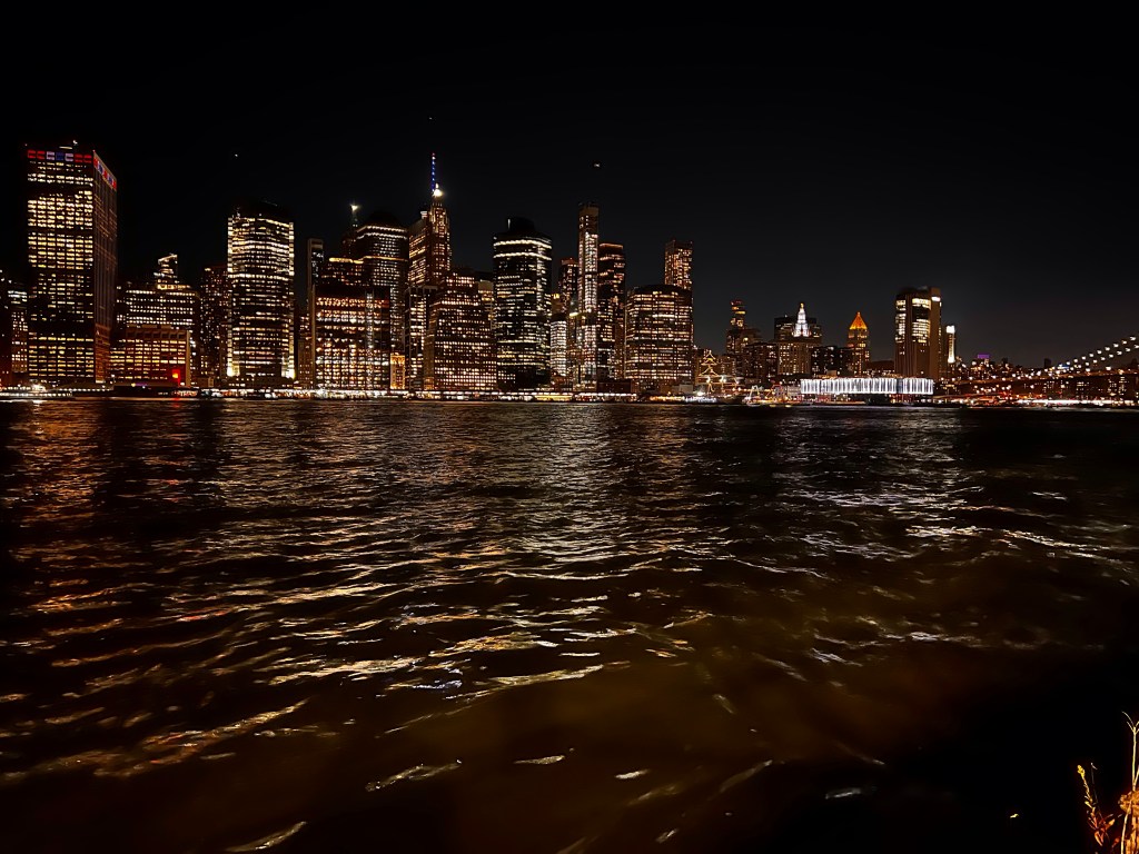
Brooklyn Bridge Park is 1.3 miles long encompassing 85 acres (!!) along the East River waterfront. Honestly, there is so much to do at this park: there are tennis courts, basketball courts, wooded areas, volleyball courts, soccer fields, running trails, ping pong tables, kayaking, pickleball, fishing, and over 120 different bird species for bird watching. But my favorite thing is the absolutely fabulous view of the Manhattan skyline and the Brooklyn Bridge.
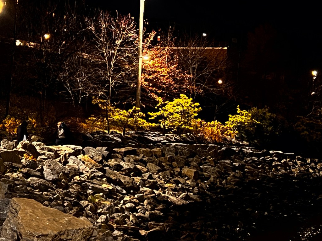
Pier Three is my favorite place to visit. It’s a wooded area with secluded grassy areas and tons of benches facing the water and the city view.
The area has gone through many different iterations since the mid-1600’s. Mostly serving as a trade route, starting with small boats and ferries, moving on to steam powered ferries in the 1800’s until railroad lines were installed in the 1850’s which lead to the construction of massive warehouses along the ferry landings and piers that jutted out from the land. Once the Brooklyn Bridge opened in 1883 the ferry trade ended and the area went through a period of neglect until the 1950’s and the construction of the BQE, which revitalized the area… for a little while. By the 1970’s the area was mostly abandoned and decrepit. In 1984 the Port Authority announced plans to sell the piers for commercial development. It wasn’t until 1998 that the planning for the Brooklyn Bridge park started in earnest, with ground being broken in February of 2008. The first pier opened to the public in 2010 with additional areas or piers opening every subsequent year until 2021 (except 2016 and 2019). You can learn more about the history of this beautiful park here: https://www.bkwaterfronthistory.org.
Manhattan SkylinePier ThreeBike lanesView of Pier three with the Manhattan skyline in the background
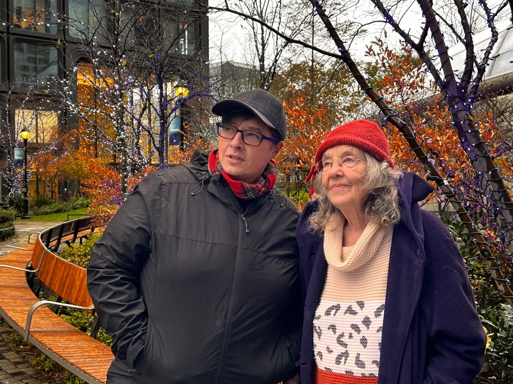
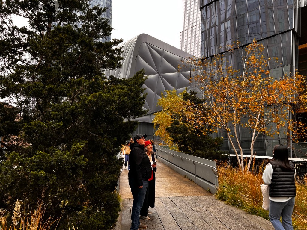
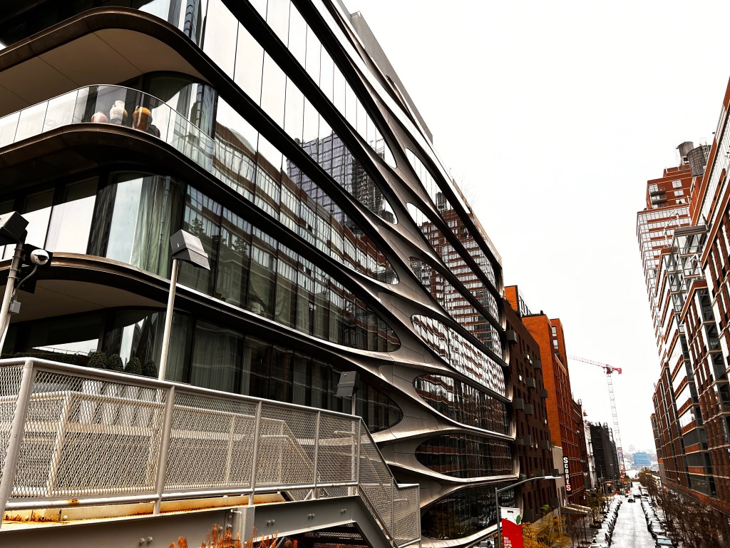
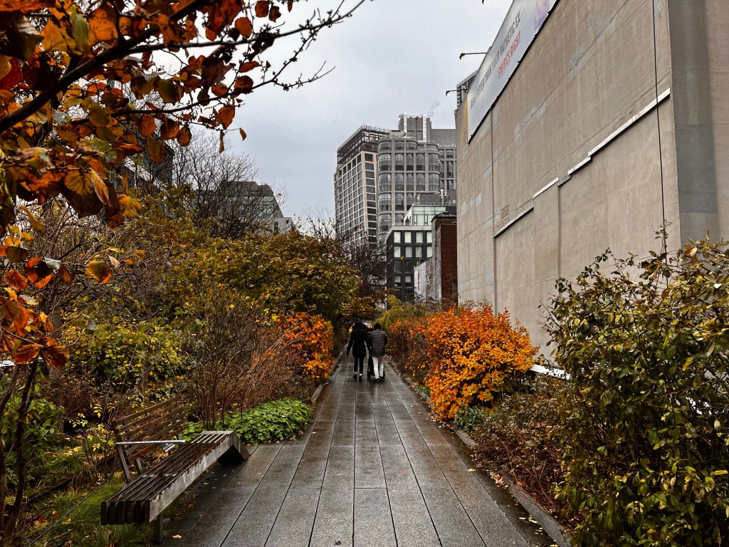
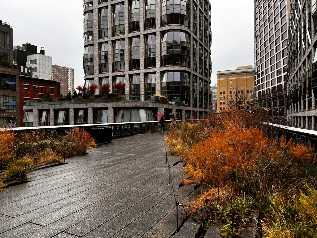
It was my birthday this past Saturday (yay for 43); since it was the Sabbath we spent the day with brethren, which is always lovely, but we didn’t get a chance to have a proper celebration. So Sunday (November 27) Lewis and I (along with my mother-in-law, Nancy) headed to the city for some fun. I wanted to walk the High Line. The High Line is one of my favorite places to spend time so it seemed like the perfect place to start Tourist Tuesdays! Each week I’ll visit a “touristy” place around the city and post about it each Tuesday.
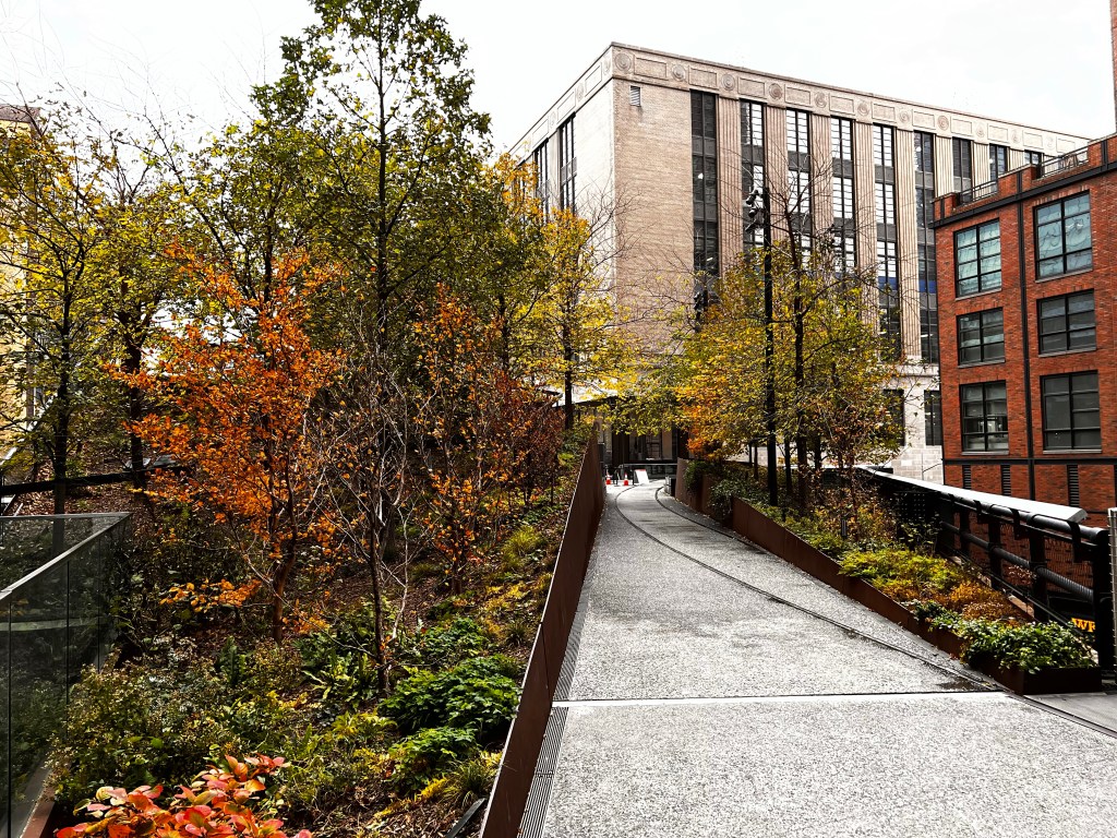
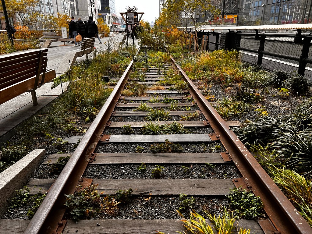
The history of the High Line dates back to the 1800’s when the area was a dangerous street-level train line that transported food to lower Manhattan (hundreds of people died being hit by trains each year). In 1933 the street-level train was transitioned to an elevated train line, and it existed as such until the 1970’s when calls for its demolition followed its declining use. Throughout the 1980’s and 1990’s it remained unused (and a considerable eyesore). It wasn’t until 2004-2006 that zoning was approved to transform the elevated train line into a park.
The first section of the park opened in 2009, followed by the second in 2012-2014, and the third (and final) section opened in 2019.
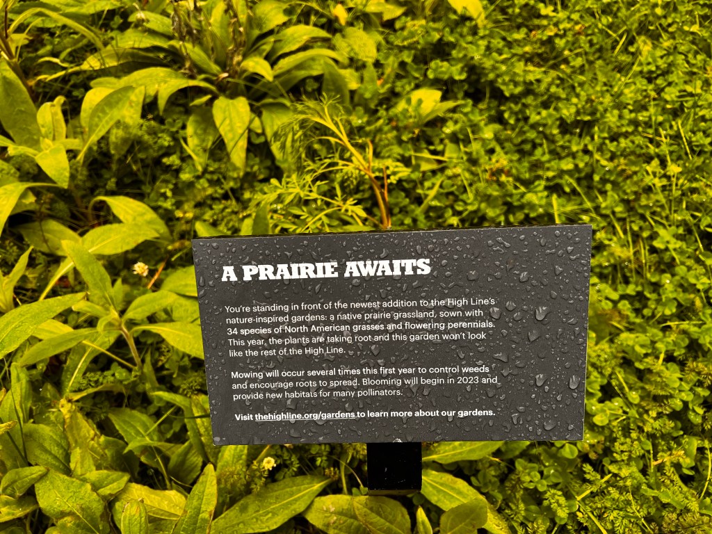
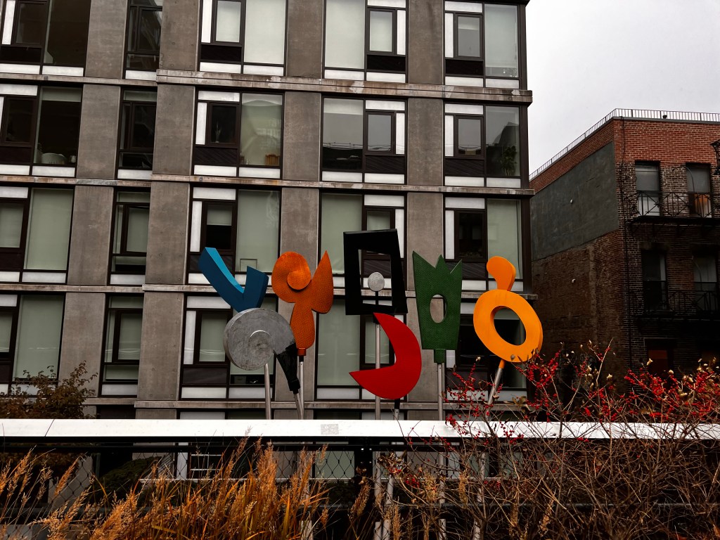
The park is 1.45 miles of continuous greenway with over 500 species of plants. Along the park are art installations, food carts, benches, and pavilions overlooking the street.
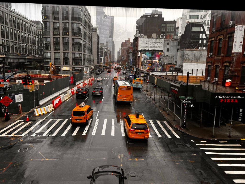
The day started out warmish, but cloudy. but partway down the path it started pouring down rain! So we cut the walk short and exited at the Chelsea Market to get warmed up and have some lunch.